
Fichier:Pizzigano.jpg
Taille de cet aperçu : 800 × 505 pixels. Autres résolutions : 320 × 202 pixels | 640 × 404 pixels | 1 024 × 646 pixels | 1 280 × 808 pixels | 2 560 × 1 616 pixels | 4 360 × 2 752 pixels.
Fichier d’origine (4 360 × 2 752 pixels, taille du fichier : 3,35 Mio, type MIME : image/jpeg)
Ce fichier et sa description proviennent de Wikimedia Commons.
Description
| Description |
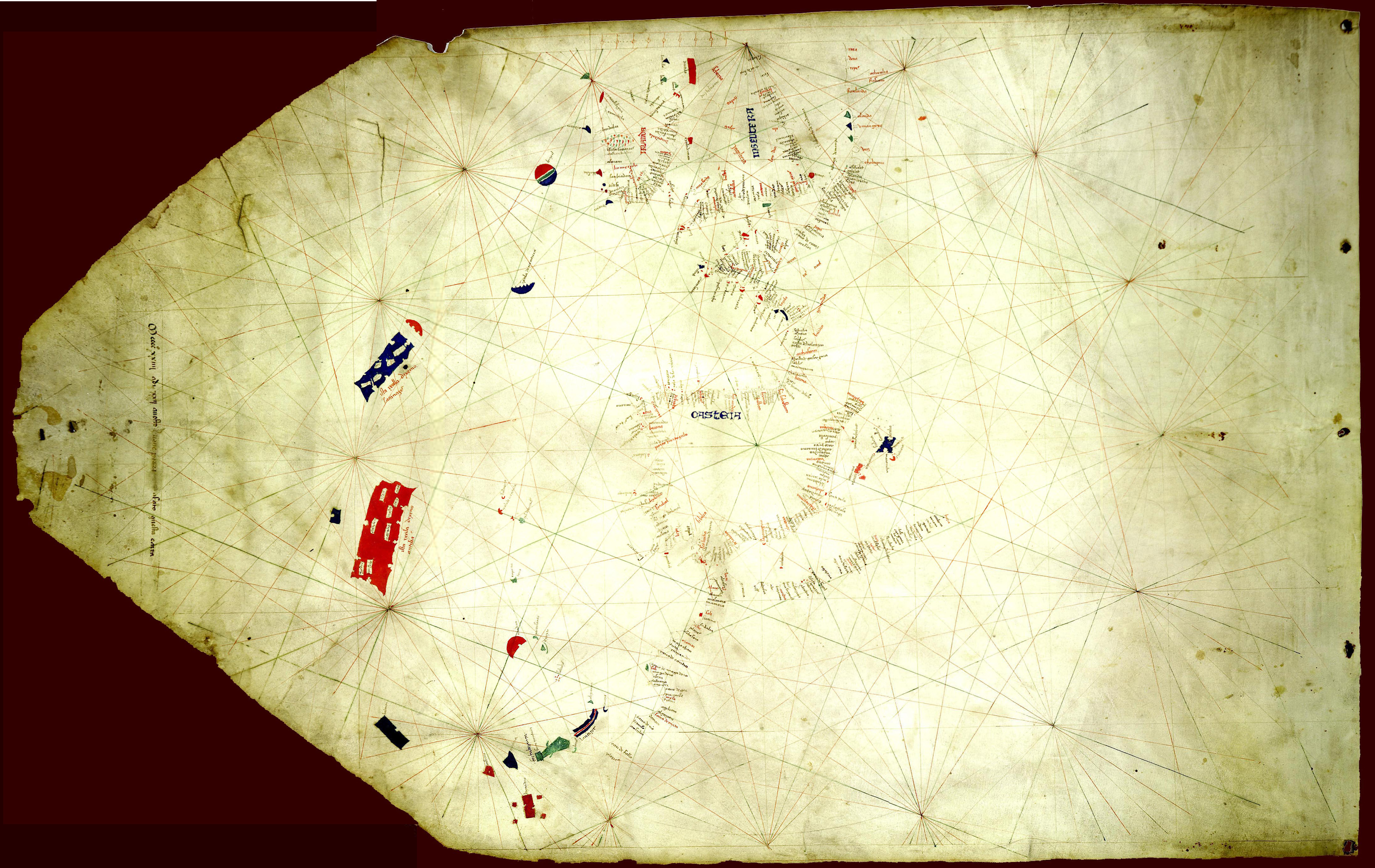
English: The Pizzigano map, also known as the Pizzigano chart is an Italian portolan chart dated 1424. It contains islands in the North Atlantic Ocean in the west of Spain and Portugal including Portuguese discoveries and legendary islands such as Antillia. The cartographer may have been the Venetian Zuane Pizigano, possibly a descendant of a 14th century family of mapmakes one of whom authored another well known map also called the Pizziagano map in Parma in 1367 |
| Date | |
| Source | University of Minnesota Libraries 8 gemonteerde screenshots. Travail personnel |
| Auteur | Pizzigiano, Zuane & XpoferenS |
| Autres versions | Œuvres dérivées de ce fichier : Pizzigano 1424 map (Antilia islands detail).JPG |
.JPG)
Conditions d’utilisation
| Moi, propriétaire des droits d’auteur sur cette œuvre, la place dans le domaine public. Ceci s'applique dans le monde entier. Dans certains pays, ceci peut ne pas être possible ; dans ce cas : J’accorde à toute personne le droit d’utiliser cette œuvre dans n’importe quel but, sans aucune condition, sauf celles requises par la loi. |
Historique du fichier
Cliquer sur une date et heure pour voir le fichier tel qu'il était à ce moment-là.
| Date et heure | Vignette | Dimensions | Utilisateur | Commentaire | |
|---|---|---|---|---|---|
| actuel | 20 novembre 2014 à 11:37 | | 4 360 × 2 752 (3,35 Mio) | Joop Rotte | Meer detail door hogere resolutie |
| 9 juin 2011 à 16:39 |  | 1 140 × 725 (190 kio) | Walrasiad | Larger version of 1424 Pizzigano chart | |
| 30 mai 2009 à 22:14 |  | 500 × 318 (34 kio) | XpoferenS | {{Information |Description={{en|1=The Pizzigano map, also known as the Pizzigano chart is an Italian portolan chart dated 1424. It contains islands in the North Atlantic Ocean in the west of Spain and Portugal including Portuguese discoveries and legendar |
Utilisation du fichier
Les 2 pages suivantes utilisent ce fichier :
Usage global du fichier
Les autres wikis suivants utilisent ce fichier :
- Utilisation sur ca.wikipedia.org
- Utilisation sur de.wikipedia.org
- Utilisation sur en.wikipedia.org
- Utilisation sur es.wikipedia.org
- Utilisation sur it.wikipedia.org
- Utilisation sur ja.wikipedia.org
- Utilisation sur pt.wikipedia.org
- Utilisation sur ru.wikipedia.org
- Utilisation sur uk.wikipedia.org
- Utilisation sur www.wikidata.org