
Fichier:Pinelli-Walckenaer Atlas (p. 3).jpg

Taille de cet aperçu : 800 × 536 pixels. Autres résolutions : 320 × 215 pixels | 640 × 429 pixels | 1 024 × 687 pixels | 1 280 × 858 pixels | 2 560 × 1 716 pixels | 4 000 × 2 682 pixels.
Fichier d’origine (4 000 × 2 682 pixels, taille du fichier : 4,79 Mio, type MIME : image/jpeg)
Ce fichier et sa description proviennent de Wikimedia Commons.
Description
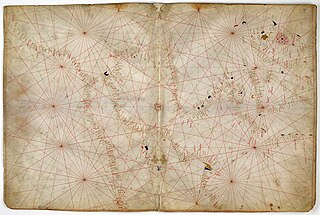
| English: Nautical chart of Western Europe, ca. 1400–1425.
( |
|
|---|---|
| Artiste |
Anonymous Venetian cartographer. |
| Titre |
English: Nautical chart of Western Europe, ca. 1400–1425. |
| Description |
English: The third sheet of the seven-sheet Pinelli-Walckenaer Atlas, a set of Italian portolan charts, depicting the west Mediterranean and north Atlantic coast, including the British Isles (it is oriented with West on top). |
| Date | Dated 1384, although in reality possibly made a little later, c. 1385–1410, and with additions from c. 1434. |
| Technique / matériaux | Ink and tempera on parchment. |
| Dimensions | hauteur : 29,4 cm ; largeur : 45 cm. |
| Collection | |
| Lieu actuel | |
| Numéro d’inventaire |
Additional M.S. 19510, folios 2v-3. |
| Références | [1]. |
| Source / photographe | [2]. |

.jpg?uselang=fr)
![[2]](http://ogimages.bl.uk/images/001/001ADD000019510U00002VRB%5BSVC2%5D.jpg)
Conditions d’utilisation
|
Cette œuvre est également dans le domaine public dans tous les pays pour lesquels le droit d’auteur a une durée de vie de 100 ans ou moins après la mort de l’auteur. | |
| Ce fichier a été identifié comme étant exempt de restrictions connues liées au droit d’auteur, y compris tous les droits connexes et voisins. | |
Historique du fichier
Cliquer sur une date et heure pour voir le fichier tel qu'il était à ce moment-là.
| Date et heure | Vignette | Dimensions | Utilisateur | Commentaire | |
|---|---|---|---|---|---|
| actuel | 29 mars 2012 à 08:40 | | 4 000 × 2 682 (4,79 Mio) | Aavindraa | large res |
| 15 juillet 2011 à 12:21 |  | 976 × 654 (315 kio) | Walrasiad | {{Information |Description ={{en|1=The second and third sheets of the seven-sheet Pinelli-Walckenaer Atlas, a set of Italian portolan charts, made by an anonymous Venetian cartographer. The atlas is explicitly dated 1384 (although possibly actually mad |
Utilisation du fichier
Les 5 pages suivantes utilisent ce fichier :
Usage global du fichier
Les autres wikis suivants utilisent ce fichier :
- Utilisation sur ca.wikipedia.org
- Utilisation sur en.wikipedia.org
.jpg)