
Fichier:PhilaDistrict.PNG
Pas de plus haute résolution disponible.
PhilaDistrict.PNG (536 × 575 pixels, taille du fichier : 21 kio, type MIME : image/png)
Ce fichier et sa description proviennent de Wikimedia Commons.
Description
| Description |
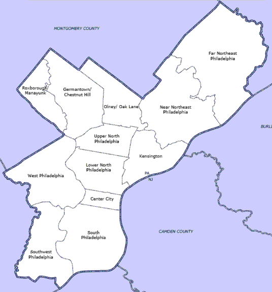
English: Map of Philadelphia County highlighting planning districts |
| Date | 5 septembre 2005 (date de téléversement originale) |
| Source | Transféré de en.wikipedia à Commons par Apollo1758 utilisant CommonsHelper. |
| Auteur | Boothy443 sur Wikipédia anglais |

|
Cette image (de type locator map) devrait être recréée dans un format vectoriel, en tant que fichier SVG. Cela offrirait plusieurs avantages : voir Commons:Media for cleanup pour plus d'informations. Si une version SVG de cette image est déjà disponible, merci de bien vouloir l'envoyer. Après cela, remplacez ce modèle par {{vector version available|nouveau nom d'image.svg}}.
|
Conditions d’utilisation
| Cette œuvre a été placée dans le domaine public par son auteur, Boothy443 sur Wikipédia anglais. Ceci s’applique dans le monde entier. Dans certains pays, ceci peut ne pas être possible ; dans ce cas : Boothy443 accorde à toute personne le droit d’utiliser cette œuvre dans n’importe quel but, sans aucune condition, sauf celles requises par la loi. |
Journal des téléversements d’origine
La page de description originale était ici. Tous les noms d'utilisateur qui suivent se rapportent à en.wikipedia.
- 2005-09-05 02:45 Boothy443 536×575× (21358 bytes) Map of Philadelphia County highlighting planning districts
Historique du fichier
Cliquer sur une date et heure pour voir le fichier tel qu'il était à ce moment-là.
| Date et heure | Vignette | Dimensions | Utilisateur | Commentaire | |
|---|---|---|---|---|---|
| actuel | 25 septembre 2010 à 03:11 | | 536 × 575 (21 kio) | Apollo1758 | {{Information |Description={{en|Map of Philadelphia County highlighting planning districts}} |Source=Transferred from [http://en.wikipedia.org en.wikipedia]; transferred to Commons by User:Apollo1758 using [http://tools.wikimedia.de/~magnus/commonshel |
Utilisation du fichier
Les 2 pages suivantes utilisent ce fichier :
Usage global du fichier
Les autres wikis suivants utilisent ce fichier :
- Utilisation sur cs.wikipedia.org
- Utilisation sur en.wikipedia.org
- List of Philadelphia neighborhoods
- National Register of Historic Places listings in Philadelphia
- Talk:National Register of Historic Places listings in Philadelphia
- Wikipedia:Graphics Lab/Map workshop/Archive/Jan 2011
- Module:Location map/data/USA Pennsylvania, Philadelphia County
- Module:Location map/data/USA Pennsylvania, Philadelphia County/doc
- Utilisation sur si.wikipedia.org