
Fichier:Pacific intertie geographic map.png
Taille de cet aperçu : 309 × 599 pixels. Autres résolutions : 124 × 240 pixels | 247 × 480 pixels | 854 × 1 655 pixels.
Fichier d’origine (854 × 1 655 pixels, taille du fichier : 154 kio, type MIME : image/png)
Ce fichier et sa description proviennent de Wikimedia Commons.
Description
| Description |
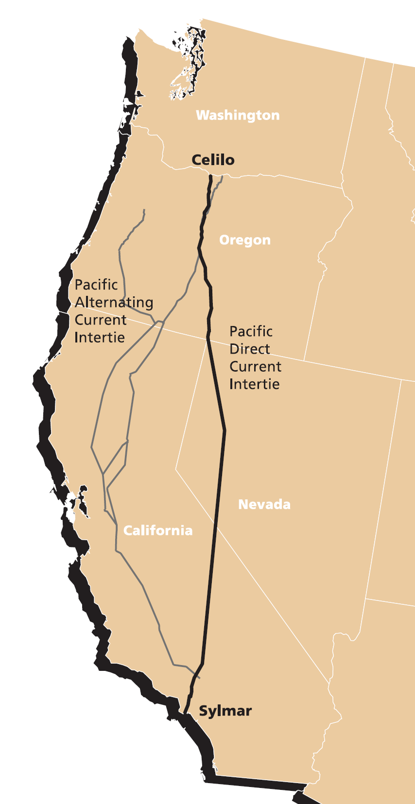
English: Map of Pacific DC Intertie (HVDC electrical transmission line) from Celilo Converter Station near The Dalles, Oregon to the Sylmar Converter Station near Los Angeles. |
| Date | source document last modified 2003-04-15, image extracted 2007-03-08 |
| Source | extracted from http://www.transmission.bpa.gov/PlanProj/Transmission_Projects/Completed-TransP/Celilo/4-15-03FactSheet.pdf |
| Auteur | Bonneville Power Administration |
Conditions d’utilisation
Ce média est dans le domaine public des États-Unis d’Amérique car son auteur est l’administration américaine comme précisé dans le code fédéral au Titre 17, Chapitre 1, Section 105. Pour en savoir plus : droit d’auteur.
Attention : Ceci ne concerne que le travail du Gouvernement Fédéral et pas celui des États, ou d’une autre subdivision géographique ou politique du pays.
|
 | |
| Ce fichier a été identifié comme étant exempt de restrictions connues liées au droit d’auteur, y compris tous les droits connexes et voisins. | ||
Historique du fichier
Cliquer sur une date et heure pour voir le fichier tel qu'il était à ce moment-là.
| Date et heure | Vignette | Dimensions | Utilisateur | Commentaire | |
|---|---|---|---|---|---|
| actuel | 9 mars 2007 à 03:59 | | 854 × 1 655 (154 kio) | EncMstr | {{Information |Description=Map of Pacific Intertie HVDC electrical transmission line from Celilo Converter Station near The Dalles, Oregon to the Sylmar Converter Station |
| 11 septembre 2006 à 10:19 |  | 361 × 601 (34 kio) | EncMstr | {{Information |Description=Map of Pacific Intertie HVDC electrical transmission line from Celilo Converter Station near The Dalles, Oregon to the Sylmar Converter Station |
Utilisation du fichier
La page suivante utilise ce fichier :
Usage global du fichier
Les autres wikis suivants utilisent ce fichier :
- Utilisation sur de.wikipedia.org
- Utilisation sur en.wikipedia.org
- Utilisation sur www.wikidata.org