Aller au contenu

Fichier:North America second level political division 2 and Greenland.svg

Le contenu de la page n’est pas pris en charge dans d’autres langues.
Une page de Wikipédia, l'encyclopédie libre.

Fichier d’origine(Fichier SVG, nominalement de 1 789 × 2 154 pixels, taille : 367 kio)

Ce fichier et sa description proviennent de Wikimedia Commons.

Description
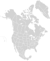
English: Map of North America and its second-level political divisions. Canadian provinces and territories, US and Mexican states. Canada, Mexico, United States.

Non-contiguous parts of a states/provinces are "grouped" together with the main area of the state/provinces, so any state/provinces can be coloured in completion with one click anywhere on the state/provinces's area.

Also, all states/provinces have a "id" attached to them, making them easy to find. Select "find" and then enter in the state/provinces's ISO 3166-2 code in the "id" field to find it. The codes can be found here (Canada), here (USA) and here (Mexico).
Date
Source

Canada and US map: BlankMap-USA-states-Canada-provinces, HI closer.svg by Lokal_Profil.
Mexico map: Mexico template.svg by Mario Fuente Cid
Greenland map: Image:Greenland.svg
Combined by Alex Covarrubias, Greenland added by carol.

 
Le code de ce fichier SVG est valide.
 
Cette image vectorielle a été créée avec Inkscape, puis modifiée à la main
.
 
W3C-validity not checked.
Auteur Alex Covarrubias
Autorisation
(Réutilisation de ce fichier)
w:fr:Creative Commons
paternité partage à l’identique
Vous êtes libre :
  • de partager – de copier, distribuer et transmettre cette œuvre
  • d’adapter – de modifier cette œuvre
Sous les conditions suivantes :
  • paternité – Vous devez donner les informations appropriées concernant l'auteur, fournir un lien vers la licence et indiquer si des modifications ont été faites. Vous pouvez faire cela par tout moyen raisonnable, mais en aucune façon suggérant que l’auteur vous soutient ou approuve l’utilisation que vous en faites.
  • partage à l’identique – Si vous modifiez, transformez, ou vous basez sur cette œuvre, vous devez distribuer votre contribution sous la même licence ou une licence compatible avec celle de l’original.
Autres versions

Œuvres dérivées de ce fichier :

Légendes

Ajoutez en une ligne la description de ce que représente ce fichier

Éléments décrits dans ce fichier

dépeint

Historique du fichier

Cliquer sur une date et heure pour voir le fichier tel qu'il était à ce moment-là.

Date et heureVignetteDimensionsUtilisateurCommentaire
actuel18 mars 2008 à 15:57Vignette pour la version du 18 mars 2008 à 15:571 789 × 2 154 (367 kio)CarolSpearsminor validation problems repaired
18 mars 2008 à 15:41Vignette pour la version du 18 mars 2008 à 15:411 789 × 2 154 (367 kio)CarolSpears{{Information |Description={{en|Map of North America and its second-level political divisions. Canadian provinces, US and Mexican states. Canada, Mexico, United States. Non-contiguous parts of a states/provinces are "grouped" together with the main area

Aucune page n’utilise ce fichier.

Usage global du fichier