
Fichier:NPS everglades-hells-bay-trail-map.jpg

Taille de cet aperçu : 800 × 579 pixels. Autres résolutions : 320 × 232 pixels | 640 × 464 pixels | 1 024 × 742 pixels | 1 193 × 864 pixels.
Fichier d’origine (1 193 × 864 pixels, taille du fichier : 277 kio, type MIME : image/jpeg)
Ce fichier et sa description proviennent de Wikimedia Commons.
Description
| Description |
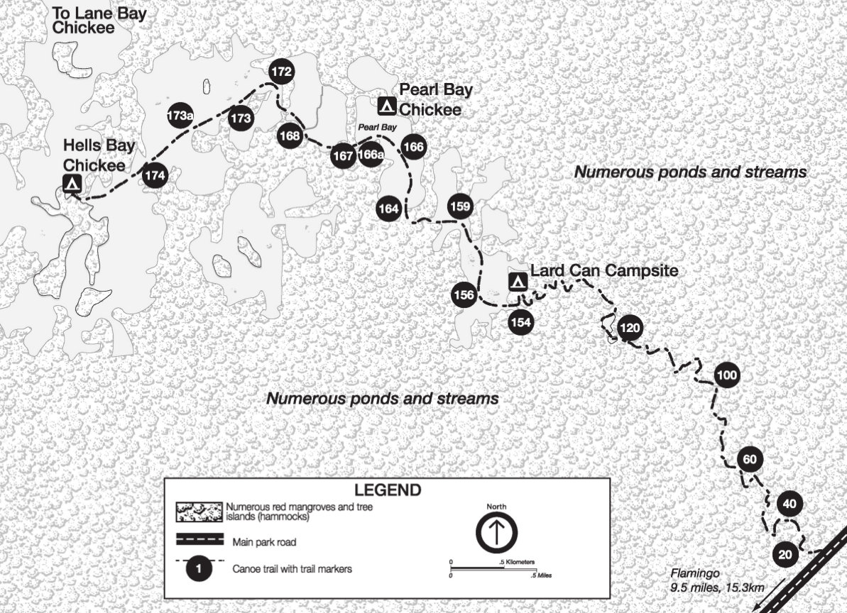
English: Map of Hell’s Bay canoe trail, located in an Everglades Mangrove Swamp northeast of Flamingo. The map shows trail markers you’ll follow along this water route. |
| Date | |
| Source | U.S. National Park Service (http://npmaps.com/wp-content/uploads/everglades-hells-bay-trail-map.jpg) |
| Auteur | U.S. National Park Service, restoration/cleanup by Matt Holly |
Conditions d’utilisation
| Cette image ou ce document multimédia contient des éléments basés sur une œuvre d'un employé du National Park Service, créé dans le cadre des tâches officielles de cette personne. En tant qu'œuvre du Gouvernement fédéral des États-Unis, une telle œuvre se trouve dans le domaine public aux États-Unis. Voir NPS website et NPS copyright policy pour plus d'informations. |
Historique du fichier
Cliquer sur une date et heure pour voir le fichier tel qu'il était à ce moment-là.
| Date et heure | Vignette | Dimensions | Utilisateur | Commentaire | |
|---|---|---|---|---|---|
| actuel | 16 mai 2017 à 23:20 | | 1 193 × 864 (277 kio) | RKBot | =={{int:filedesc}}== {{Information |description= {{en|1=Map of Hell’s Bay canoe trail, located in an Everglades Mangrove Swamp northeast of Flamingo. The map shows trail markers you’ll follow along this water route.}} |date= 2013-11-03 |source= U.S... |
Utilisation du fichier
La page suivante utilise ce fichier :
Usage global du fichier
Les autres wikis suivants utilisent ce fichier :
- Utilisation sur www.wikidata.org