
Fichier:Muddy Water Red desert.jpg
Taille de cet aperçu : 800 × 600 pixels. Autres résolutions : 320 × 240 pixels | 640 × 480 pixels | 1 024 × 768 pixels | 1 280 × 960 pixels | 2 560 × 1 920 pixels.
Fichier d’origine (2 560 × 1 920 pixels, taille du fichier : 2,23 Mio, type MIME : image/jpeg)
Ce fichier et sa description proviennent de Wikimedia Commons.
Description
| Description |
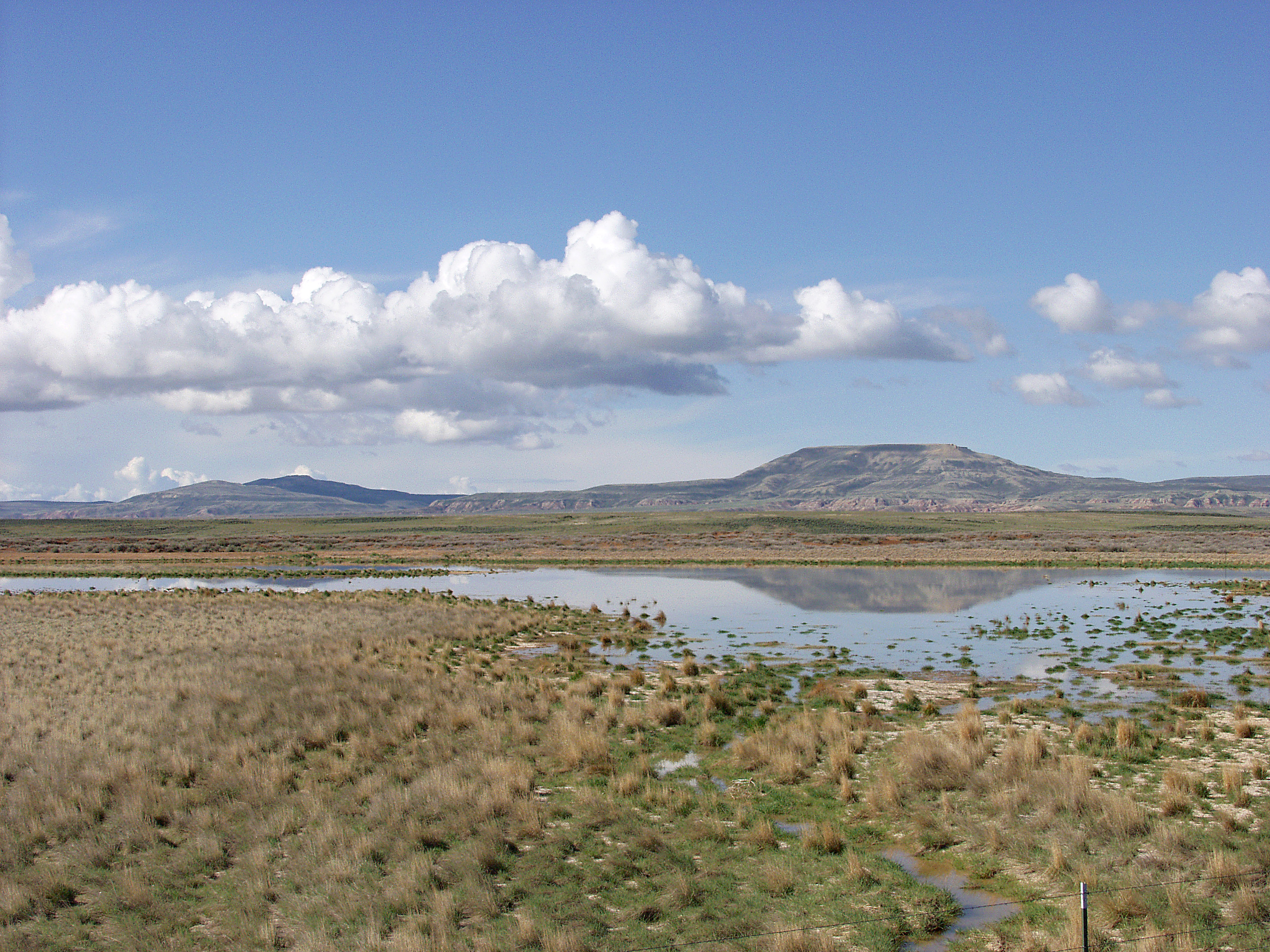
English: Melting snowpack is the primary source for surface water in Wyoming, such as this emphemeral wetland in the Muddy Creek Watershed of the Red Desert. This stretch of rangeland is typical of the vast expanses of publicly owned rangeland that aerial remote sensing is particularly well-adapted to. |
| Date | Date inconnue |
| Source | http://www.ars.usda.gov/is/graphics/photos/feb06/d423-1.htm |
| Auteur | US Department of Agriculture. Sam Cox |
| Autorisation (Réutilisation de ce fichier) |
US Federal Government work |
Conditions d’utilisation
| Cette image est dans le domaine public car elle contient une œuvre qui proviennent originellement de le service de recherche sur l'agricuture, l'agence de recherche du Département de l'agriculture des États-Unis.
|
Historique du fichier
Cliquer sur une date et heure pour voir le fichier tel qu'il était à ce moment-là.
| Date et heure | Vignette | Dimensions | Utilisateur | Commentaire | |
|---|---|---|---|---|---|
| actuel | 21 avril 2009 à 19:05 | | 2 560 × 1 920 (2,23 Mio) | Fishdecoy | {{Information |Description={{en|1=This stretch of rangeland in the Muddy Creek Watershed in Wyoming’s Red Desert is typical of the vast expanses of publicly owned rangeland that aerial remote sensing is particularly well-adapted to.}} |Source=http://www |
Utilisation du fichier
La page suivante utilise ce fichier :
Usage global du fichier
Les autres wikis suivants utilisent ce fichier :
- Utilisation sur ar.wikipedia.org
- Utilisation sur arz.wikipedia.org
- Utilisation sur ca.wikipedia.org
- Utilisation sur ceb.wikipedia.org
- Utilisation sur cs.wikipedia.org
- Utilisation sur en.wikipedia.org
- Utilisation sur fa.wikipedia.org
- Utilisation sur it.wikipedia.org
- Utilisation sur ka.wikipedia.org
- Utilisation sur lt.wikipedia.org
- Utilisation sur vi.wikipedia.org
- Utilisation sur www.wikidata.org