
Fichier:Mapa del Estado de Panamá (1865).jpg

Taille de cet aperçu : 800 × 519 pixels. Autres résolutions : 320 × 208 pixels | 640 × 415 pixels | 1 024 × 664 pixels | 1 280 × 830 pixels | 2 560 × 1 661 pixels | 5 488 × 3 560 pixels.
Fichier d’origine (5 488 × 3 560 pixels, taille du fichier : 8,74 Mio, type MIME : image/jpeg)
Ce fichier et sa description proviennent de Wikimedia Commons.
.jpg?uselang=fr)
Description
| Description |
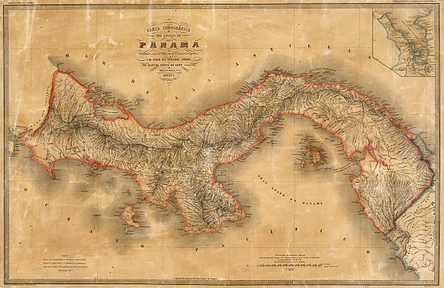
Español: Carta Corográfica del Estado Soberano de Panamá. Tomado del "Atlas de los Estados Unidos de Colombia, antigua Nueva Granada", 1865. |
| Date | |
| Source | Carta corográfica del estado de Panamá, Atlas de los Estados Unidos de Colombia, 1865 |
| Auteur | Manuel Ponce de León y Manuel María Paz |
Conditions d’utilisation
This file is in the public domain because the copyright of this work, registered in Colombia, has expired, according to “Law 23 of 1982 on Copyright, Articles 11, 21-29”, amended by “Law 44 of 1993, Article 2” and “Law 1520 of 2012, Articles 4, 6 and 10” (details). However, some restrictions have to be addressed:
|

|
Historique du fichier
Cliquer sur une date et heure pour voir le fichier tel qu'il était à ce moment-là.
| Date et heure | Vignette | Dimensions | Utilisateur | Commentaire | |
|---|---|---|---|---|---|
| actuel | 26 janvier 2018 à 20:00 | | 5 488 × 3 560 (8,74 Mio) | Milenioscuro | mayor resolución |
| 4 février 2015 à 05:37 |  | 2 436 × 1 580 (2,41 Mio) | Milenioscuro | mas grande | |
| 5 novembre 2011 à 20:59 |  | 1 136 × 748 (190 kio) | Milenioscuro | {{Information |Description ={{es|1=Carta Corográfica del Estado Soberano de Panamá. Tomado del "Atlas de los Estados Unidos de Colombia, antigua Nueva Granada", 1865.}} |Source =[http://banrepcultural.org/category/autores-dccreator/ponce-de-l |
Utilisation du fichier
La page suivante utilise ce fichier :
Usage global du fichier
Les autres wikis suivants utilisent ce fichier :
- Utilisation sur ar.wikipedia.org
- Utilisation sur en.wikipedia.org
- Utilisation sur es.wikipedia.org
- Utilisation sur mt.wikipedia.org
.jpg)