
Fichier:Map of the 2021 Caymanian general election.svg

Taille de cet aperçu PNG pour ce fichier SVG : 732 × 600 pixels. Autres résolutions : 293 × 240 pixels | 586 × 480 pixels | 937 × 768 pixels | 1 250 × 1 024 pixels | 2 499 × 2 048 pixels | 1 534 × 1 257 pixels.
Fichier d’origine (Fichier SVG, nominalement de 1 534 × 1 257 pixels, taille : 177 kio)
Ce fichier et sa description proviennent de Wikimedia Commons.
Description
| Description |
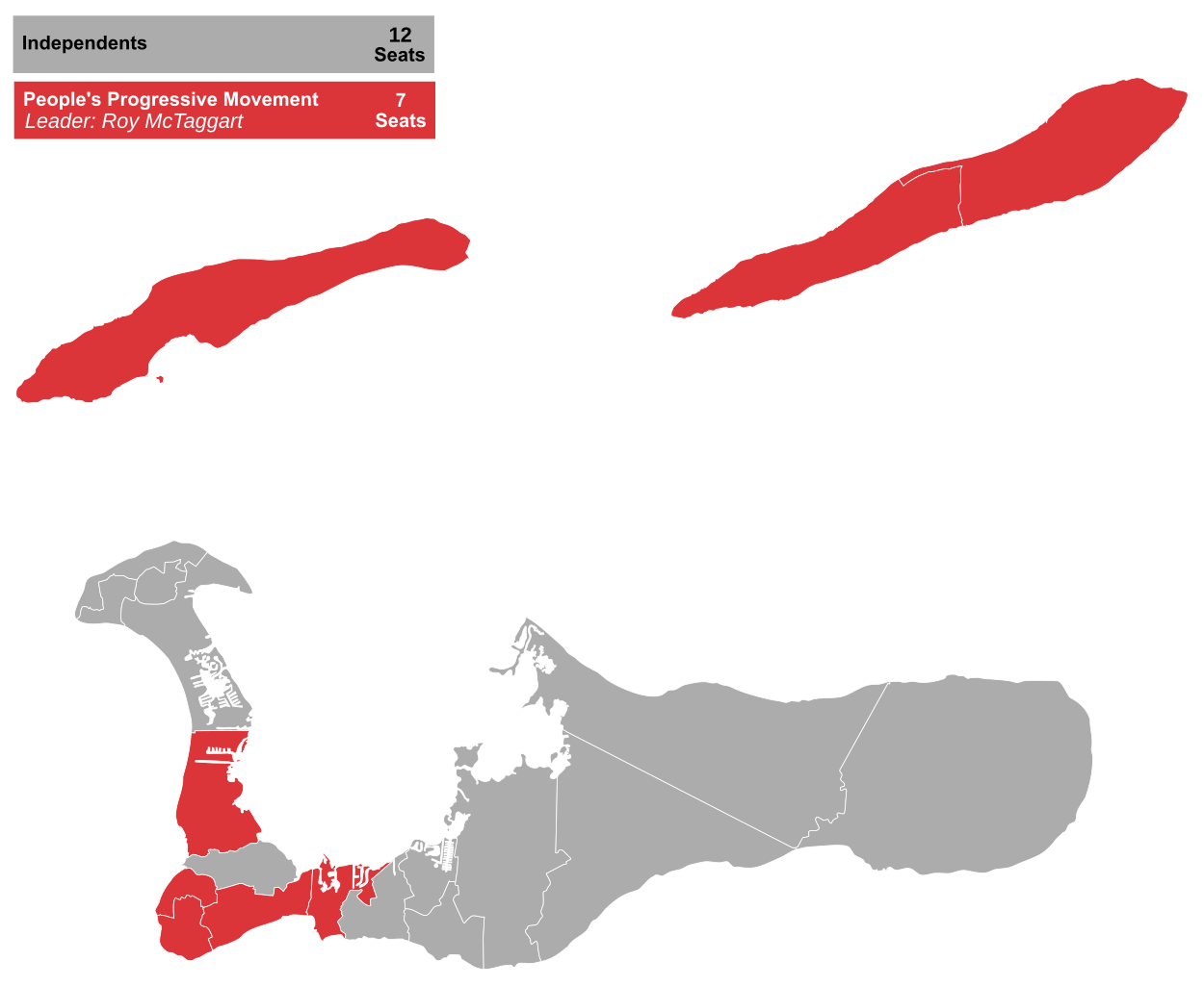
English: Results of the 2021 Caymanian general election in 19 constituencies for the Legislative Assembly. |
| Date | |
| Source | Travail personnel using File:Map of the 2017 Caymanian general election.svg |
| Auteur | RaviC, JDuggan (original) |
Conditions d’utilisation
Moi, en tant que détenteur des droits d’auteur sur cette œuvre, je la publie sous la licence suivante :
Ce fichier est sous la licence Creative Commons Attribution – Partage dans les Mêmes Conditions 4.0 International.
- Vous êtes libre :
- de partager – de copier, distribuer et transmettre cette œuvre
- d’adapter – de modifier cette œuvre
- Sous les conditions suivantes :
- paternité – Vous devez donner les informations appropriées concernant l'auteur, fournir un lien vers la licence et indiquer si des modifications ont été faites. Vous pouvez faire cela par tout moyen raisonnable, mais en aucune façon suggérant que l’auteur vous soutient ou approuve l’utilisation que vous en faites.
- partage à l’identique – Si vous modifiez, transformez, ou vous basez sur cette œuvre, vous devez distribuer votre contribution sous la même licence ou une licence compatible avec celle de l’original.
Historique du fichier
Cliquer sur une date et heure pour voir le fichier tel qu'il était à ce moment-là.
| Date et heure | Vignette | Dimensions | Utilisateur | Commentaire | |
|---|---|---|---|---|---|
| actuel | 30 avril 2021 à 12:28 | | 1 534 × 1 257 (177 kio) | RaviC | layout |
| 30 avril 2021 à 12:26 |  | 1 534 × 1 257 (177 kio) | RaviC | =={{int:filedesc}}== {{Information |description={{en|1=Results of the 2021 Caymanian general election in 19 constituencies for the Legislative Assembly.}} |date=30.04.2021 |source={{own}} using File:Map of the 2017 Caymanian general election.svg |author=RaviC, JDuggan (original) |permission= |other versions= }} =={{int:license-header}}== {{self|cc-by-sa-4.0}} Category:Election maps of British Overseas Territories |
Utilisation du fichier
La page suivante utilise ce fichier :
Usage global du fichier
Les autres wikis suivants utilisent ce fichier :
- Utilisation sur en.wikipedia.org
- Utilisation sur es.wikipedia.org