
Fichier:Map of Sullivan County Indiana Townships.svg

Taille de cet aperçu PNG pour ce fichier SVG : 512 × 512 pixels. Autres résolutions : 240 × 240 pixels | 480 × 480 pixels | 768 × 768 pixels | 1 024 × 1 024 pixels | 2 048 × 2 048 pixels.
Fichier d’origine (Fichier SVG, nominalement de 512 × 512 pixels, taille : 53 kio)
Ce fichier et sa description proviennent de Wikimedia Commons.
| Description |
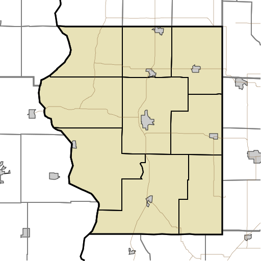
English: This is a map of the townships in Sullivan County, Indiana, USA. |
| Date | (UTC) |
| Source | |
| Auteur |
|
Moi, en tant que détenteur des droits d’auteur sur cette œuvre, je la publie sous la licence suivante :
| Moi, propriétaire des droits d’auteur sur cette œuvre, la place dans le domaine public. Ceci s'applique dans le monde entier. Dans certains pays, ceci peut ne pas être possible ; dans ce cas : J’accorde à toute personne le droit d’utiliser cette œuvre dans n’importe quel but, sans aucune condition, sauf celles requises par la loi. |
Journal des téléversements d’origine
This image is a derivative work of the following images:
- File:Map_highlighting_Cass_Township,_Sullivan_County,_Indiana.svg licensed with PD-self
- 2007-11-24T20:01:54Z File Upload Bot (Omnedon) 512x512 (26387 Bytes) == Summary == {{Information |Description={{en|This is a map of Sullivan County, Indiana, USA which highlights the location of Cass Township.}} |Source=My own work, using freely-available TIGER data and custom-written MapScri
Téléversé avec derivativeFX
Historique du fichier
Cliquer sur une date et heure pour voir le fichier tel qu'il était à ce moment-là.
| Date et heure | Vignette | Dimensions | Utilisateur | Commentaire | |
|---|---|---|---|---|---|
| actuel | 17 août 2010 à 20:17 | | 512 × 512 (53 kio) | Sweet kate | {{Information |Description={{en|This is a map of the townships in Sullivan County, Indiana, USA.}} |Source=*File:Map_highlighting_Cass_Township,_Sullivan_County,_Indiana.svg |Date=2010-08-17 18:13 (UTC) |Author=*[[:File:Map_highlighting_Cass_Townshi |
Utilisation du fichier
La page suivante utilise ce fichier :
Usage global du fichier
Les autres wikis suivants utilisent ce fichier :
- Utilisation sur ar.wikipedia.org
- Utilisation sur azb.wikipedia.org
- Utilisation sur ceb.wikipedia.org
- Utilisation sur en.wikipedia.org
- Union Christian College, Merom
- Cass, Indiana
- Fairbanks, Indiana
- Graysville, Indiana
- Jackson Hill, Indiana
- New Lebanon, Indiana
- Paxton, Indiana
- Pleasantville, Indiana
- Riverton, Indiana
- Scott City, Indiana
- Sullivan County Airport
- Module:Location map/data/USA Indiana Sullivan County/doc
- Baldridge, Indiana
- Benefiel Corner, Indiana
- Bucktown, Indiana
- Dodds Bridge, Indiana
- Gambill, Indiana
- Glendora, Indiana
- Greenville, Sullivan County, Indiana
- Merom Station, Indiana
- Riverview, Indiana
- Scotchtown, Indiana
- Shiloh, Indiana
- Standard, Indiana
- Stringtown, Sullivan County, Indiana
- Wilfred, Indiana
- Baker, Indiana
- East Shelburn, Indiana
- Hawton, Indiana
- Jericho, Indiana
- Curryville, Sullivan County, Indiana
- Sullivan County Courthouse (Indiana)
- Sherman Building (Sullivan, Indiana)
- Shelburn station
- Massacre, Indiana
- Caledonia, Indiana
- Farnsworth, Indiana
- Module:Location map/data/USA Indiana Sullivan County
- Utilisation sur fa.wikipedia.org
Voir davantage sur l’utilisation globale de ce fichier.