
Fichier:Karte Nordostgrönland Koch 1911.png

Fichier d’origine (1 196 × 1 542 pixels, taille du fichier : 1,46 Mio, type MIME : image/png)
Ce fichier et sa description proviennent de Wikimedia Commons.
Description
| Description |
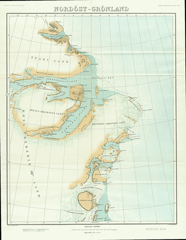
English: Map of North East Greenland by Johan Peter Koch as surveyed during the Danmark Expedition 1906-1908
Deutsch: Johan Peter Kochs Karte Nordostgrönlands, angefertigt nach der Landvermessung durch die Danmark-Expedition 1906-1908 |
| Date | |
| Source | J. P. Koch: Danmark-Ekspeditionens Kort, Geografisk Tidsskrift, 21 ,1911–1912, p. 167–177 ([1], p. 4 of 18) |
| Auteur | Johan Peter Koch (1870-1928) |
Conditions d’utilisation
|
Cette œuvre est également dans le domaine public dans tous les pays pour lesquels le droit d’auteur a une durée de vie de 70 ans ou moins après la mort de l’auteur.
| |
| Ce fichier a été identifié comme étant exempt de restrictions connues liées au droit d’auteur, y compris tous les droits connexes et voisins. | |
Historique du fichier
Cliquer sur une date et heure pour voir le fichier tel qu'il était à ce moment-là.
| Date et heure | Vignette | Dimensions | Utilisateur | Commentaire | |
|---|---|---|---|---|---|
| actuel | 20 janvier 2019 à 13:21 | | 1 196 × 1 542 (1,46 Mio) | Ratzer | bessere Auflösung? (Test) |
| 3 juin 2015 à 22:27 |  | 990 × 1 290 (677 kio) | Cmdrjameson | Compressed with pngout. Reduced by 823kB (54% decrease). | |
| 13 juin 2014 à 11:24 |  | 990 × 1 290 (1,47 Mio) | Dreizung | {{Information |Description ={{en|1=Map of North East Greenland by Johan Peter Koch as surveyed during the Danmark Expedition 1906-1908}} {{de|1=Johan Peter Kochs Karte Nordostgrönlands, angefertigt nach der Landvermessung durch die Danmark-Expediti... |
Utilisation du fichier
Les 9 pages suivantes utilisent ce fichier :
Usage global du fichier
Les autres wikis suivants utilisent ce fichier :
- Utilisation sur ceb.wikipedia.org
- Utilisation sur da.wikipedia.org
- Utilisation sur de.wikipedia.org
- Utilisation sur en.wikipedia.org
- Danmark Fjord
- Hagen Fjord
- Frederick E. Hyde Fjord
- Zachariae Isstrom
- Lynn Island
- Princess Thyra Island
- Holm Land
- Ingolf Fjord
- Academy Glacier (Greenland)
- Lambert Land
- Cape Bridgman
- Mylius-Erichsen Land
- Mallemuk Mountain
- Roosevelt Range
- Daly Range
- Flade Isblink
- Amdrup Land
- Antarctic Bay (Greenland)
- Wyckoff Land
- Cape Clarence Wyckoff
- Herluf Trolle Land
- Utilisation sur es.wikipedia.org
- Utilisation sur fa.wikipedia.org
- Utilisation sur fi.wikipedia.org
- Utilisation sur it.wikipedia.org
- Utilisation sur nl.wikipedia.org
- Utilisation sur sv.wikipedia.org
- Utilisation sur www.wikidata.org