
Fichier:Israel and arab states map.png
Pas de plus haute résolution disponible.
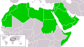
Israel_and_arab_states_map.png (336 × 188 pixels, taille du fichier : 11 kio, type MIME : image/png)
Ce fichier et sa description proviennent de Wikimedia Commons.
zfdsde
| Cette œuvre a été placée dans le domaine public par son auteur, Humus sapiens. Ceci s’applique dans le monde entier. Dans certains pays, ceci peut ne pas être possible ; dans ce cas : |
Historique du fichier
Cliquer sur une date et heure pour voir le fichier tel qu'il était à ce moment-là.
| Date et heure | Vignette | Dimensions | Utilisateur | Commentaire | |
|---|---|---|---|---|---|
| actuel | 18 mars 2018 à 23:51 | | 336 × 188 (11 kio) | Maphobbyist | Reverted to version as of 14:02, 9 July 2011 (UTC) |
| 21 janvier 2017 à 14:15 |  | 336 × 188 (23 kio) | عادل | correction of Egypt borders | |
| 9 juillet 2011 à 16:02 |  | 336 × 188 (11 kio) | Maphobbyist | South Sudan has become independent on July 9, 2011. Sudan and South Sudan are shown with the new international border between them. | |
| 21 avril 2005 à 01:23 |  | 336 × 188 (9 kio) | Ondrejk | {{GFDL}} Based on Image:BlankMap-World.png copied from EN Wiki |
Utilisation du fichier
Aucune page n’utilise ce fichier.
Usage global du fichier
Les autres wikis suivants utilisent ce fichier :
- Utilisation sur en.wikipedia.org
- Utilisation sur eo.wikipedia.org
- Utilisation sur hu.wikipedia.org
- Utilisation sur id.wikipedia.org
- Utilisation sur ko.wikipedia.org
- Utilisation sur min.wikipedia.org
- Utilisation sur no.wikipedia.org
- Utilisation sur pl.wikipedia.org
- Utilisation sur sk.wikipedia.org
- Utilisation sur zh-yue.wikipedia.org