
Fichier:Indian Kingdom of Mewar map.svg

Taille de cet aperçu PNG pour ce fichier SVG : 530 × 599 pixels. Autres résolutions : 212 × 240 pixels | 425 × 480 pixels | 680 × 768 pixels | 906 × 1 024 pixels | 1 812 × 2 048 pixels | 1 639 × 1 852 pixels.
Fichier d’origine (Fichier SVG, nominalement de 1 639 × 1 852 pixels, taille : 551 kio)
Ce fichier et sa description proviennent de Wikimedia Commons.
Description
| Description |
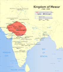
English: Indian Kingdom of Mewar map |
| Date | |
| Source | Travail personnel |
| Auteur | Nikel3012 |
Conditions d’utilisation
Moi, en tant que détenteur des droits d’auteur sur cette œuvre, je la publie sous la licence suivante :
Ce fichier est disponible selon les termes de la licence Creative Commons Attribution 4.0 International.
- Vous êtes libre :
- de partager – de copier, distribuer et transmettre cette œuvre
- d’adapter – de modifier cette œuvre
- Sous les conditions suivantes :
- paternité – Vous devez donner les informations appropriées concernant l'auteur, fournir un lien vers la licence et indiquer si des modifications ont été faites. Vous pouvez faire cela par tout moyen raisonnable, mais en aucune façon suggérant que l’auteur vous soutient ou approuve l’utilisation que vous en faites.
Historique du fichier
Cliquer sur une date et heure pour voir le fichier tel qu'il était à ce moment-là.
| Date et heure | Vignette | Dimensions | Utilisateur | Commentaire | |
|---|---|---|---|---|---|
| actuel | 1 juin 2024 à 09:36 | | 1 639 × 1 852 (551 kio) | Nikel3012 | Reverted to version as of 18:01, 20 May 2024 (UTC) |
| 1 juin 2024 à 09:33 |  | 1 639 × 1 852 (544 kio) | Nikel3012 | Removed less important powers of that time | |
| 20 mai 2024 à 20:01 |  | 1 639 × 1 852 (551 kio) | Nikel3012 | Colour Change | |
| 6 mai 2024 à 17:51 |  | 1 639 × 1 852 (540 kio) | Nikel3012 | Reverted to version as of 02:36, 27 April 2024 (UTC) | |
| 6 mai 2024 à 17:50 |  | 1 639 × 1 852 (529 kio) | Nikel3012 | Minor Change | |
| 6 mai 2024 à 17:42 |  | 1 639 × 1 852 (533 kio) | Nikel3012 | More Clear Version of the Map | |
| 27 avril 2024 à 04:36 |  | 1 639 × 1 852 (540 kio) | Nikel3012 | Fixed Vijaynagar Empire's position | |
| 26 avril 2024 à 11:12 |  | 1 639 × 1 852 (540 kio) | Rawn3012 | Reverted to version as of 00:21, 26 April 2024 (UTC) | |
| 26 avril 2024 à 03:54 |  | 1 639 × 1 852 (539 kio) | Nikel3012 | Improved Image | |
| 26 avril 2024 à 02:21 |  | 1 639 × 1 852 (540 kio) | Nikel3012 | Minor Changes |
Utilisation du fichier
La page suivante utilise ce fichier :
Usage global du fichier
Les autres wikis suivants utilisent ce fichier :
- Utilisation sur en.wikipedia.org
- Utilisation sur ko.wikipedia.org
- Utilisation sur ru.wikipedia.org