
Fichier:Horseshoe bend map.jpg
Taille de cet aperçu : 671 × 600 pixels. Autres résolutions : 269 × 240 pixels | 537 × 480 pixels | 859 × 768 pixels | 1 244 × 1 112 pixels.
Fichier d’origine (1 244 × 1 112 pixels, taille du fichier : 231 kio, type MIME : image/jpeg)
Ce fichier et sa description proviennent de Wikimedia Commons.
Description
| Description |
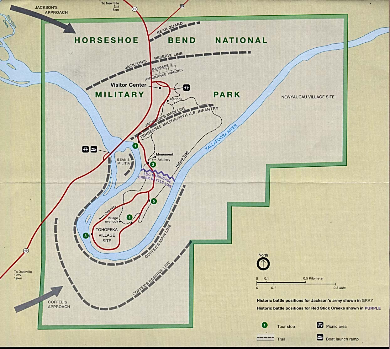
English: This image is held in the PCL Map Collection at the University of Texas Libraries, The University of Texas at Austin. (Copyrighted material in this collection is clearly marked.) The map shows the Horseshoe Bend National Military Park and is annotated with the historical battle positions of Jackson's Army and the Creek Red Sticks. |
| Date | 1er août 2005 (date de téléversement originale) |
| Source | Transféré de en.wikipedia à Commons. Retrieved from here |
| Auteur | "Courtesy of the University of Texas Libraries, The University of Texas at Austin." |
Conditions d’utilisation
See online license
| Cette œuvre a été placée dans le domaine public par son auteur, PCL Map Collection at the University of Texas Libraries. Ceci s’applique dans le monde entier. Dans certains pays, ceci peut ne pas être possible ; dans ce cas : PCL Map Collection at the University of Texas Libraries accorde à toute personne le droit d’utiliser cette œuvre dans n’importe quel but, sans aucune condition, sauf celles requises par la loi.
|
Journal des téléversements d’origine
La page de description originale était ici. Tous les noms d'utilisateur qui suivent se rapportent à en.wikipedia.
- 2005-08-01 20:12 Vern Reisenleiter 1244×1112× (236405 bytes) This image is held in the PCL Map Collection at the University of Texas Libraries, The University of Texas at Austin. (Copyrighted material in this collection is clearly marked.) The map shows the Horseshoe Bend National Miltary Park and is annotat
Historique du fichier
Cliquer sur une date et heure pour voir le fichier tel qu'il était à ce moment-là.
| Date et heure | Vignette | Dimensions | Utilisateur | Commentaire | |
|---|---|---|---|---|---|
| actuel | 23 juin 2014 à 17:59 | | 1 244 × 1 112 (231 kio) | Jalo | Transferred from en.wikipedia |
Utilisation du fichier
Aucune page n’utilise ce fichier.
Usage global du fichier
Les autres wikis suivants utilisent ce fichier :
- Utilisation sur ca.wikipedia.org
- Utilisation sur en.wikipedia.org
- Utilisation sur en.wikivoyage.org
- Utilisation sur it.wikipedia.org
- Utilisation sur ru.wikipedia.org