
Fichier:FAB's BlaschakCoalCompany IMG 4470 coal washing water separation, drying, recycling plant.JPG
Fichier d’origine (2 048 × 1 536 pixels, taille du fichier : 453 kio, type MIME : image/jpeg)
Ce fichier et sa description proviennent de Wikimedia Commons.
Description
| Lieu de la prise de vue | | Voir cet endroit et d’autres images sur : OpenStreetMap |
|---|
| Description |
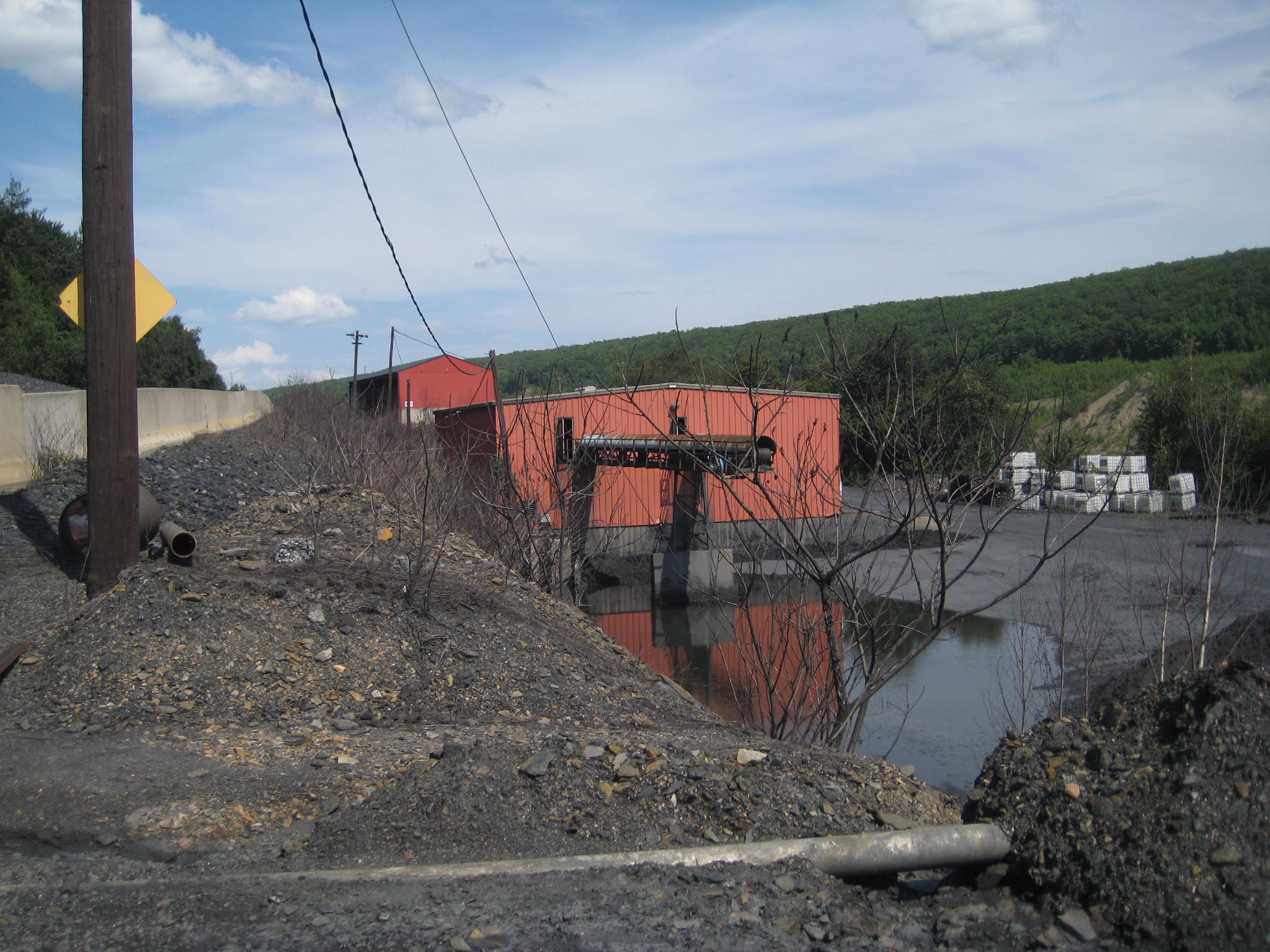
English: *Blaschak Coal Company Coal breaker/CPP Plant: 40°55′03″N 75°59′43″W / 40.917555°N 75.995276°W
New St. Nicholas Coal Breaker, Pennsylvania Route 54 Mahanoy City, PA 17948 The Employee that gave us access to the property described the purpose of this building in the foreground as a water reclamation and filtration building. The conveyor offloads anthracite powder from the centrifugal water separator, which according to that worthy, is shipped out wet to a nearby power plant. The wetness is not a deep pond, but a large shallow puddle bedded in anthracite coal dust over a concrete driveway, which is spacious. Aerial view shows the circular tell-tales of coal heaps there, and a nearby articulated loader, so the area is used a heap storage site. A similar stockpile area is evident across the street traversing across the slope-face above the building. That street forms a wye with the steep switchback roads near u-turn, so acts as a semi-dumper pre-loading staging area. Trailer trucks and dump trucks ascending the hill to load sorted anthracite would pull into the street, off the sharp-curve of the switchback's turn; where they can then back across the street to the sorted anthracite loading area. When loaded, they can make the tight hairpin turn around and down to the scales near the administration building. (See #IMG_4467-excluding John, this is the view the driver would have after backing down in this manner) |
| Date | |
| Source | Travail personnel |
| Auteur | Fabartus |
Conditions d’utilisation
- Vous êtes libre :
- de partager – de copier, distribuer et transmettre cette œuvre
- d’adapter – de modifier cette œuvre
- Sous les conditions suivantes :
- paternité – Vous devez donner les informations appropriées concernant l'auteur, fournir un lien vers la licence et indiquer si des modifications ont été faites. Vous pouvez faire cela par tout moyen raisonnable, mais en aucune façon suggérant que l’auteur vous soutient ou approuve l’utilisation que vous en faites.
- partage à l’identique – Si vous modifiez, transformez, ou vous basez sur cette œuvre, vous devez distribuer votre contribution sous la même licence ou une licence compatible avec celle de l’original.
Historique du fichier
Cliquer sur une date et heure pour voir le fichier tel qu'il était à ce moment-là.
| Date et heure | Vignette | Dimensions | Utilisateur | Commentaire | |
|---|---|---|---|---|---|
| actuel | 24 août 2013 à 06:31 | | 2 048 × 1 536 (453 kio) | Fabartus | User created page with UploadWizard |
Utilisation du fichier
La page suivante utilise ce fichier :