
Fichier:Extensión del ruso2.png
Pas de plus haute résolution disponible.
Extensión_del_ruso2.png (380 × 315 pixels, taille du fichier : 89 kio, type MIME : image/png)
Ce fichier et sa description proviennent de Wikimedia Commons.
| Description |
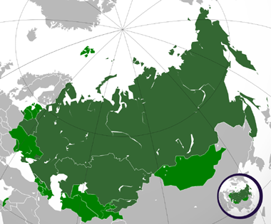
Español: Extensión del ruso. |
| Date | (UTC) |
| Source | |
| Auteur |
|
.svg)
Moi, en tant que détenteur des droits d’auteur sur cette œuvre, je la publie sous les licences suivantes :
Ce fichier est disponible selon les termes de la licence Creative Commons Attribution 3.0 Non transposée.
- Vous êtes libre :
- de partager – de copier, distribuer et transmettre cette œuvre
- d’adapter – de modifier cette œuvre
- Sous les conditions suivantes :
- paternité – Vous devez donner les informations appropriées concernant l'auteur, fournir un lien vers la licence et indiquer si des modifications ont été faites. Vous pouvez faire cela par tout moyen raisonnable, mais en aucune façon suggérant que l’auteur vous soutient ou approuve l’utilisation que vous en faites.
Cette carte a été créée avec le Generic Mapping Tools : https://www.generic-mapping-tools.org/ utilisant pour le relief un ou plusieurs de ces jeux de données du domaine public :
|

|
Vous avez la permission de copier, distribuer et modifier ce document selon les termes de la GNU Free Documentation License version 1.2 ou toute version ultérieure publiée par la Free Software Foundation, sans sections inaltérables, sans texte de première page de couverture et sans texte de dernière page de couverture. Un exemplaire de la licence est inclus dans la section intitulée GNU Free Documentation License. |
Vous pouvez choisir l’une de ces licences.
Journal des téléversements d’origine
This image is a derivative work of the following images:
- File:Russian_Federation_(orthographic_projection).svg licensed with Cc-by-3.0, GFDL-GMT
- 2008-11-24T03:09:11Z Shibo77 541x541 (586989 Bytes) {{Information |Description=.. |Source=.. |Date=.. |Author=Ssolbergj |Permission=.. |other_versions=.. }}
- 2008-10-30T17:14:56Z Shibo77 541x541 (586026 Bytes) +Kurilojn k Grandan Diomedeon
- 2008-10-21T00:09:37Z Ssolbergj 541x541 (583897 Bytes) {{Information |Description= |Source= |Date= |Author= |Permission= |other_versions= }}
- 2008-10-21T00:01:03Z Ssolbergj 765x990 (426047 Bytes) {{Information |Description={{en|1=Russia}} |Source=Own work by uploader |Author=[[User:Ssolbergj|Ssolbergj]] |Date= |Permission= |other_versions= }} [[Category:Maps of Russia]]
Téléversé avec derivativeFX
Historique du fichier
Cliquer sur une date et heure pour voir le fichier tel qu'il était à ce moment-là.
| Date et heure | Vignette | Dimensions | Utilisateur | Commentaire | |
|---|---|---|---|---|---|
| actuel | 20 juillet 2015 à 04:00 | | 380 × 315 (89 kio) | Viet-hoian1 | Actualización de Donetsk y Lugansk |
| 8 avril 2014 à 22:33 |  | 380 × 315 (73 kio) | Iñaki Salazar | Reverted to version as of 12:32, 21 March 2014 | |
| 21 mars 2014 à 17:40 |  | 380 × 315 (91 kio) | Bobek | Reverted to version as of 22:59, 5 March 2011 | |
| 21 mars 2014 à 14:32 |  | 380 × 315 (73 kio) | Мечников | Крым | |
| 6 mars 2011 à 00:59 |  | 380 × 315 (91 kio) | Wadim | Mapa confuso; mezcla idioma oficial (nacional) con oficial (local) (especialmente en Ucrania); podría existir con explicación apropiada como imagen independiente de esta | |
| 7 février 2011 à 07:11 |  | 380 × 315 (66 kio) | Fobos92 | Mapa en tres colores. | |
| 7 janvier 2010 à 02:55 |  | 380 × 315 (91 kio) | Wadim | {{Information |Description={{en|Russia on the globe.}} {{ru|Россия на глобусе.}} {{tr|'''Rusya''''nın yerküre üzerindeki konumu.}} |Source=*File:Russian_Federation_(orthographic_projection).svg |Date=2010-01-07 00:44 (UTC) |Aut |
.svg)
Utilisation du fichier
Aucune page n’utilise ce fichier.
Usage global du fichier
Les autres wikis suivants utilisent ce fichier :
- Utilisation sur alt.wikipedia.org
- Utilisation sur ru.wikipedia.org