
Fichier:Earth-DSCOVR-20150706-IFV.jpg
Fichier d’origine (1 788 × 1 756 pixels, taille du fichier : 646 kio, type MIME : image/jpeg)
Ce fichier et sa description proviennent de Wikimedia Commons.
Description
| Description |
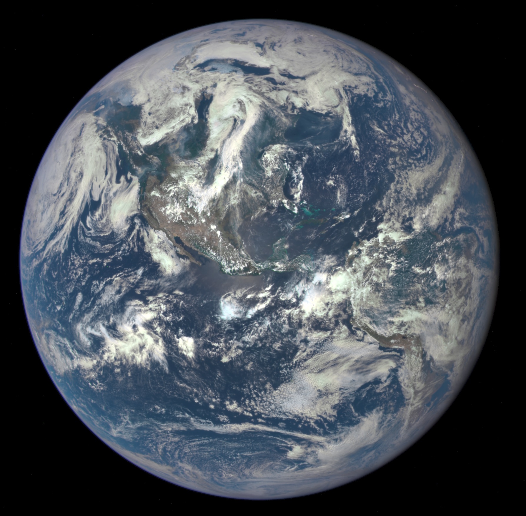
English: NASA Captures "EPIC" Earth Image
A NASA camera on the Deep Space Climate Observatory satellite has returned its first view of the entire sunlit side of Earth from nearly one million miles away. This color image of Earth was taken by NASA’s Earth Polychromatic Imaging Camera (EPIC), a four megapixel CCD camera and telescope. The image was generated by combining three separate images to create a photographic-quality image. The camera takes a series of 10 images using different narrowband filters -- from ultraviolet to near infrared -- to produce a variety of science products. The red, green and blue channel images are used in these color images. The image was taken July 6, 2015, showing North and Central America. The central turquoise areas are shallow seas around the Caribbean islands. This Earth image shows the effects of sunlight scattered by air molecules, giving the image a characteristic bluish tint. The EPIC team is working to remove this atmospheric effect from subsequent images. Once the instrument begins regular data acquisition, EPIC will provide a daily series of Earth images allowing for the first time study of daily variations over the entire globe. These images, available 12 to 36 hours after they are acquired, will be posted to a dedicated web page by September 2015. The primary objective of DSCOVR, a partnership between NASA, the National Oceanic and Atmospheric Administration (NOAA) and the U.S. Air Force, is to maintain the nation’s real-time solar wind monitoring capabilities, which are critical to the accuracy and lead time of space weather alerts and forecasts from NOAA. |
| Date | Prise le 6 juillet 2015, 19:01:11 |
| Source | http://www.nasa.gov/image-feature/nasa-captures-epic-earth-image (image link); see also https://epic.gsfc.nasa.gov/?date=2015-07-06 image #3. |
| Auteur | NASA |
| Autres versions |
|


Conditions d’utilisation
| Ce fichier provient de la NASA. Sauf exception, les documents créés par la NASA ne sont pas soumis à copyright. Pour plus d'informations, voir la politique de copyright de la NASA. | ||
 |
Attention :
|
Historique du fichier
Cliquer sur une date et heure pour voir le fichier tel qu'il était à ce moment-là.
| Date et heure | Vignette | Dimensions | Utilisateur | Commentaire | |
|---|---|---|---|---|---|
| actuel | 21 juillet 2015 à 13:18 | | 1 788 × 1 756 (646 kio) | JorisvS | crop a bit |
| 20 juillet 2015 à 18:01 |  | 2 048 × 2 048 (1,49 Mio) | Drbogdan | User created page with UploadWizard |
Utilisation du fichier
Les 3 pages suivantes utilisent ce fichier :
Usage global du fichier
Les autres wikis suivants utilisent ce fichier :
- Utilisation sur ca.wikipedia.org
- Utilisation sur en.wikipedia.org
- Utilisation sur en.wikiquote.org
- Utilisation sur en.wikiversity.org
- Utilisation sur es.wikipedia.org
- Utilisation sur gl.wikipedia.org
- Utilisation sur he.wikipedia.org
- Utilisation sur incubator.wikimedia.org
- Utilisation sur it.wikipedia.org
- Utilisation sur ja.wikipedia.org
- Utilisation sur pl.wikipedia.org
- Utilisation sur ru.wikipedia.org
- Utilisation sur ru.wiktionary.org
- Utilisation sur tr.wikiquote.org
- Utilisation sur uk.wikipedia.org
- Utilisation sur www.wikidata.org
- Utilisation sur wuu.wikipedia.org