
Fichier:Detailed map of Uniontown, Ohio.png
Pas de plus haute résolution disponible.
Detailed_map_of_Uniontown,_Ohio.png (575 × 425 pixels, taille du fichier : 54 kio, type MIME : image/png)
Ce fichier et sa description proviennent de Wikimedia Commons.
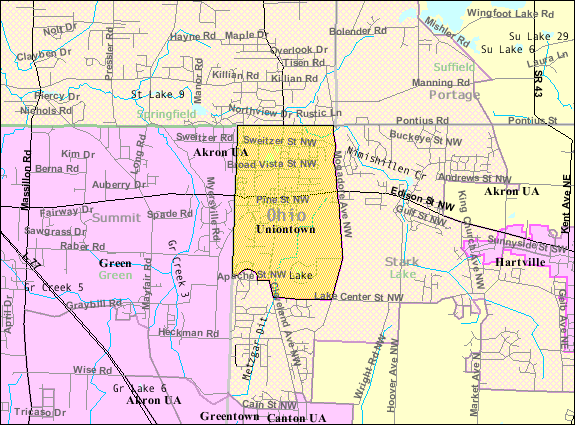
| Description | Map of Uniontown, a census-designated place (CDP) in Stark County, Ohio, United States, with its boundaries at the time of the 2000 census. | |||
| Date | Date inconnue; downloaded by me on 13 December 2008 | |||
| Source | http://factfinder.census.gov/leg2/07/120826507.gif, from http://factfinder.census.gov | |||
| Auteur | United States Census Bureau | |||
| Autorisation (Réutilisation de ce fichier) |
|

Historique du fichier
Cliquer sur une date et heure pour voir le fichier tel qu'il était à ce moment-là.
| Date et heure | Vignette | Dimensions | Utilisateur | Commentaire | |
|---|---|---|---|---|---|
| actuel | 14 décembre 2008 à 04:16 | | 575 × 425 (54 kio) | Nyttend | {{Information |Description=Map of {{w|Uniontown, Ohio|Uniontown}}, a {{w|census-designated place}} (CDP) in {{w|Stark County, Ohio|Stark County}}, {{w|Ohio}}, {{w|United States}}, with its boundaries at the time of the {{w|2000 United States Census|2000 c |
Utilisation du fichier
La page suivante utilise ce fichier :
Usage global du fichier
Les autres wikis suivants utilisent ce fichier :
- Utilisation sur azb.wikipedia.org
- Utilisation sur en.wikipedia.org
- Utilisation sur fa.wikipedia.org
- Utilisation sur sh.wikipedia.org
- Utilisation sur ur.wikipedia.org