
Fichier:Croatian Prevlaka in occupation by Montenegro and Serbia.jpg
Pas de plus haute résolution disponible.
Croatian_Prevlaka_in_occupation_by_Montenegro_and_Serbia.jpg (760 × 560 pixels, taille du fichier : 118 kio, type MIME : image/jpeg)
Ce fichier et sa description proviennent de Wikimedia Commons.
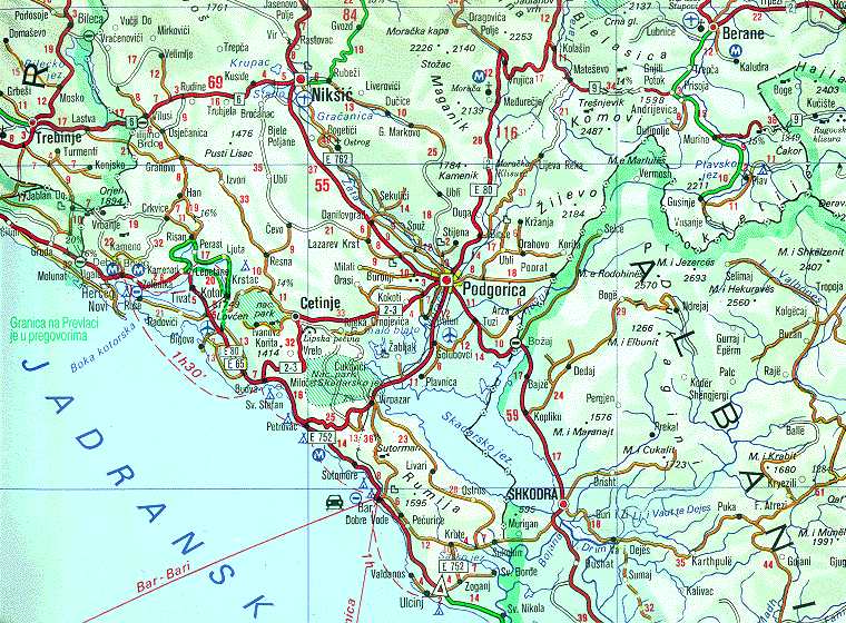
| Description | Map of Montenegrin Littoral Region and Boka kotorska in the time of occupation of Croatian Prevlaka Region which is the remaining part of Boka kotorska that belongs to Croatia. | |||
| Date | 1991-2002 (occupation ended 1992-10-20 at 20:30) (UNMIK mission ended 2002-12-20). | |||
| Source | Ministry of Foreign Affairs of the State Union Serbia and Montenegro (before that MFA of Federal Republic of Yugoslavia | |||
| Auteur | Serbian Official Cartography (Public Service at the time). | |||
| Autorisation (Réutilisation de ce fichier) |
|
|||
| Autres versions | Geographical version. |

Historique du fichier
Cliquer sur une date et heure pour voir le fichier tel qu'il était à ce moment-là.
| Date et heure | Vignette | Dimensions | Utilisateur | Commentaire | |
|---|---|---|---|---|---|
| actuel | 16 février 2008 à 04:05 | | 760 × 560 (118 kio) | Imbris~commonswiki | {{Information |Description=Map of Montenegrin ''Littoral Region'' and ''Boka kotorska'' in the time of occupation of Croatian hr:Prevlaka Region which is the remaining part of Boka kotorska that belongs to Croatia. |Source=[http://www.mfa.gov.yu/Fact |
Utilisation du fichier
La page suivante utilise ce fichier :
Usage global du fichier
Les autres wikis suivants utilisent ce fichier :
- Utilisation sur ca.wikipedia.org
- Utilisation sur ckb.wikipedia.org
- Utilisation sur de.wikipedia.org
- Utilisation sur en.wikipedia.org
- Utilisation sur fa.wikipedia.org
- Utilisation sur hr.wikipedia.org
- Utilisation sur id.wikipedia.org
- Utilisation sur mzn.wikipedia.org
- Utilisation sur nl.wikipedia.org
- Utilisation sur ru.wikipedia.org
- Utilisation sur sh.wikipedia.org
- Utilisation sur sq.wikipedia.org
- Utilisation sur www.wikidata.org
- Utilisation sur zh.wikipedia.org