
Fichier:County Down UK location map.svg

Fichier d’origine (Fichier SVG, nominalement de 742 × 812 pixels, taille : 1,73 Mio)
Ce fichier et sa description proviennent de Wikimedia Commons.
| Description |
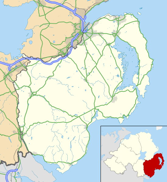
Map of County Down, UK with the following information shown:
Geographic limits:
|
|||
| Date | ||||
| Source |
Ordnance Survey of Northern Ireland OpenData
Ordnance Survey OpenData
|
|||
| Auteur | Nilfanion, created using OSNI data | |||
| Autorisation (Réutilisation de ce fichier) |
Ce fichier est disponible selon les termes de la licence Creative Commons Attribution – Partage dans les Mêmes Conditions 3.0 (non transposée). Attribution: Contains LPS Intellectual Property and Ordnance Survey data © Crown copyright and database right 2016
|
Historique du fichier
Cliquer sur une date et heure pour voir le fichier tel qu'il était à ce moment-là.
| Date et heure | Vignette | Dimensions | Utilisateur | Commentaire | |
|---|---|---|---|---|---|
| actuel | 15 mai 2016 à 14:45 | | 742 × 812 (1,73 Mio) | Nilfanion | {{Information |Description=Map of County Down, UK with the following information shown: *Administrative borders *Coastline, lakes and rivers *Roads and railways *Urban areas Equirectangular map projection on WGS 84 datum, with N/S s... |
Utilisation du fichier
La page suivante utilise ce fichier :
Usage global du fichier
Les autres wikis suivants utilisent ce fichier :
- Utilisation sur en.wikipedia.org
- Downpatrick
- Newcastle, County Down
- Newtownards
- List of monastic houses in Ireland
- Bangor, County Down
- Dundrum, County Down
- Ardglass
- Donaghadee
- Warrenpoint
- Rostrevor
- Portaferry
- Kilkeel
- Killyleagh
- Comber
- Copeland Islands
- Royal Hillsborough
- Kircubbin, County Down
- Burr Point
- Carryduff
- Holywood, County Down
- Ballynahinch, County Down
- Crossgar
- Castlewellan
- Saintfield
- Annalong
- Slieve Donard
- Silent Valley Reservoir
- Magheralin
- Dromore, County Down
- Mayobridge
- Mazetown
- Hilltown, County Down
- Bangor Abbey
- Lurganare
- Millisle
- Ulster Folk and Transport Museums
- Dundonald, County Down
- Groomsport
- Ballela
- Kinallen
- Portavogie
- Bleary
- Gilford, County Down
- Loughinisland
- Strangford
- Páirc Esler
- Ballynoe, County Down
- Helen's Bay
- Rathfriland
- Cultra
Voir davantage sur l’utilisation globale de ce fichier.