
Fichier:Bolohoveni land from A.V. Boldur description.PNG
Pas de plus haute résolution disponible.
Bolohoveni_land_from_A.V._Boldur_description.PNG (278 × 267 pixels, taille du fichier : 115 kio, type MIME : image/png)
Ce fichier et sa description proviennent de Wikimedia Commons.
Description
| Description |
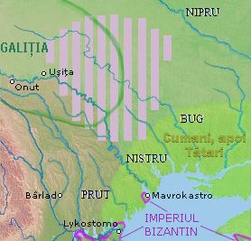
English: a map of a historical region, between Nistru and Nipru rivers, Northern Black Sea. |
| Date | |
| Source |
in May 7, 2013, only for Wiki pages |
| Auteur | Eurocentral, background from NASA - drawing generated since data from NASA Johnson Space Center - Earth Sciences and Image Analysis (NASA-JSC-ES&IA) ([1] Mission-Roll-Frame ISS001-E-5577, NASA Shuttle Radar Topography Mission (SRTM30) and/or Natural Earth, PD) |
| Ce fichier est disponible selon les termes de la licence Creative Commons CC0 Don universel au domaine public. | |
| La personne qui a associé une œuvre avec cet acte l’a placée dans le domaine public en renonçant mondialement à tous ses droits sur cette œuvre en vertu des lois relatives au droit d’auteur, ainsi qu’à tous les droits juridiques connexes et voisins qu’elle possédait sur l’œuvre, sans autre limite que celles imposées par la loi. Vous pouvez copier, modifier, distribuer et utiliser cette œuvre, y compris à des fins commerciales, sans qu’il soit nécessaire d’en demander la permission.
|
Historique du fichier
Cliquer sur une date et heure pour voir le fichier tel qu'il était à ce moment-là.
| Date et heure | Vignette | Dimensions | Utilisateur | Commentaire | |
|---|---|---|---|---|---|
| actuel | 17 septembre 2021 à 05:00 | | 278 × 267 (115 kio) | Trecătorul răcit | Left the cities, remove their hypothetic borders |
| 13 juillet 2016 à 20:25 |  | 278 × 267 (115 kio) | Julieta39 | More colours, Cumans & later Tatars | |
| 30 mars 2014 à 22:42 |  | 278 × 267 (112 kio) | Spiridon Ion Cepleanu | More details according with Nicolae Iorga & Alexandru Boldur | |
| 8 mai 2013 à 08:30 |  | 278 × 320 (116 kio) | Eurocentral | {{subst:Upload marker added by en.wp UW}} {{Information |Description = {{en|a map of a historical region, between Nistru and Nipru rivers, Northern Black Sea.}} |Source = in May 7, 2013, only for Wiki pages<br/> '''Previously published:''' only for Wik... |
Utilisation du fichier
Aucune page n’utilise ce fichier.
Usage global du fichier
Les autres wikis suivants utilisent ce fichier :
- Utilisation sur en.wikipedia.org
- Utilisation sur ro.wikipedia.org
- Utilisation sur ru.wikipedia.org
- Utilisation sur sl.wikipedia.org
- Utilisation sur sr.wikipedia.org
- Utilisation sur uk.wikipedia.org
- Utilisation sur www.wikidata.org