
Fichier:BelgicaI GermaniaI.jpg
Taille de cet aperçu : 500 × 600 pixels. Autres résolutions : 200 × 240 pixels | 587 × 704 pixels.
Fichier d’origine (587 × 704 pixels, taille du fichier : 164 kio, type MIME : image/jpeg)
Ce fichier et sa description proviennent de Wikimedia Commons.
Description
| Description |
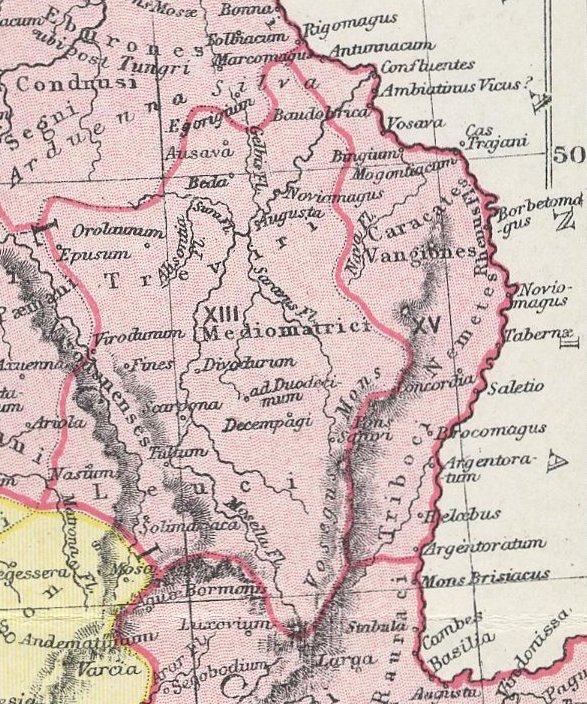
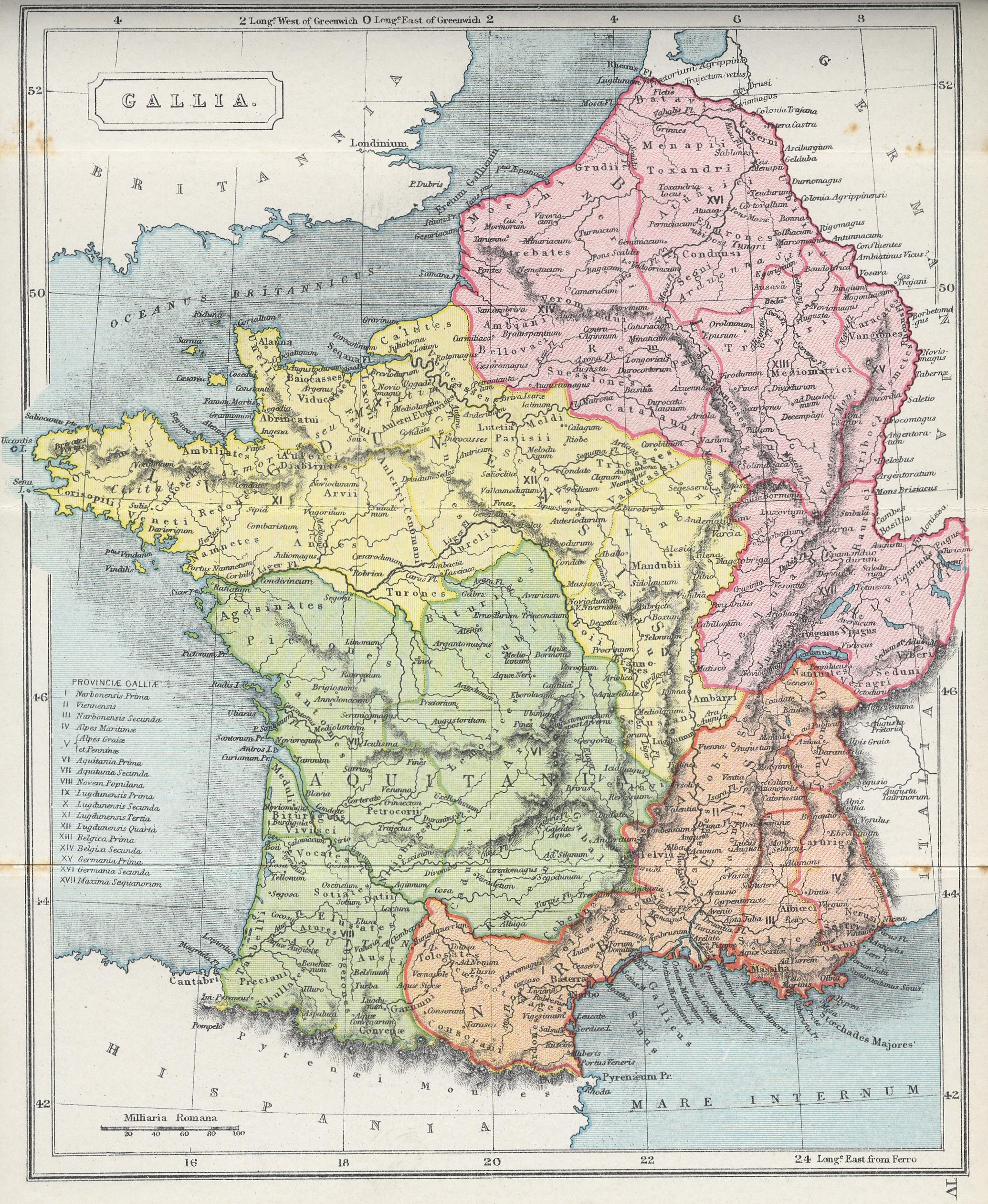
English: A section of the map "GALLIA," from The Atlas of Ancient and Classical Geography showing the late Roman provinces of Germania Prima and Belgica Prima.
Interlingua: Un section del mappa "GALLIA," ex The Atlas of Ancient and Classical Geography monstrante le provincias roman tardive de Germania Prime e Belgica Prime. |
| Date | |
| Source | Project Gutenberg: http://www.gutenberg.org/files/17124/17124-h/images/gallia.jpg |
| Auteur | Samuel Butler |
| Autres versions | Centrone map.jpg |
Conditions d’utilisation
Ce document est dans le domaine public aux États-Unis. Ceci s'applique aux travaux des États-Unis où le copyright a expiré, souvent parce que sa première publication s'est produite avant le 1er janvier 1929. Voir cette page pour davantage d'explication.
|
 | |
 |
Cette image peut ne pas être dans le domaine public en dehors des États-Unis (ceci s'applique particulièrement au Canada, en Chine (pas Hong Kong, Macao, ni Taïwan), en Allemagne ou en Suisse). Le créateur et l'année de la publication sont l'information essentielle et doivent être fournis.
|
Historique du fichier
Cliquer sur une date et heure pour voir le fichier tel qu'il était à ce moment-là.
| Date et heure | Vignette | Dimensions | Utilisateur | Commentaire | |
|---|---|---|---|---|---|
| actuel | 27 février 2010 à 23:19 | | 587 × 704 (164 kio) | QuartierLatin1968 | {{Information |Description={{en|1=A section of the map "GALLIA," from ''The Atlas of Ancient and Classical Geography'' showing the late Roman provinces of Germania Prima and Belgica Prima.}} {{ia|1=Un section del mappa "GALLIA," ex ''The Atlas of Ancient |
Utilisation du fichier
La page suivante utilise ce fichier :
Usage global du fichier
Les autres wikis suivants utilisent ce fichier :
- Utilisation sur bg.wikipedia.org
- Utilisation sur ca.wikipedia.org
- Utilisation sur cs.wikipedia.org
- Utilisation sur da.wikipedia.org
- Utilisation sur de.wikipedia.org
- Utilisation sur en.wikipedia.org
- Utilisation sur fr.wiktionary.org
- Utilisation sur it.wikipedia.org
- Utilisation sur la.wikipedia.org
- Utilisation sur lb.wikipedia.org
- Utilisation sur no.wikipedia.org
- Utilisation sur sr.wikipedia.org