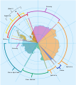
Fichier:Antarctica, territorial claims.svg
Apparence
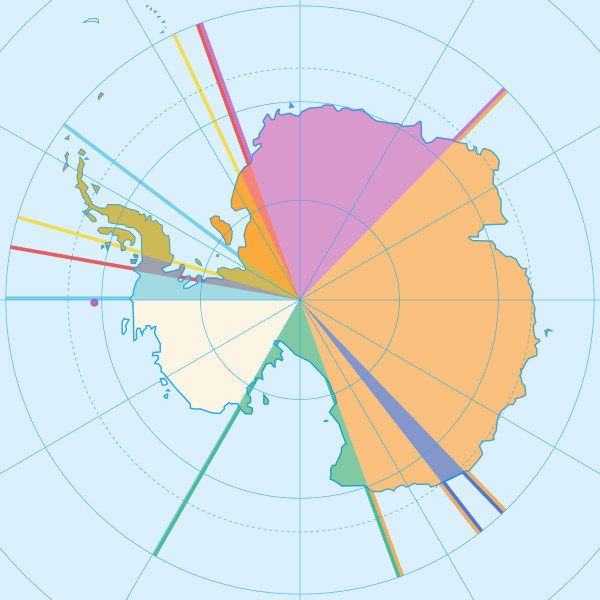
Taille de cet aperçu PNG pour ce fichier SVG : 600 × 600 pixels. Autres résolutions : 240 × 240 pixels | 480 × 480 pixels | 768 × 768 pixels | 1 024 × 1 024 pixels | 2 048 × 2 048 pixels | 820 × 820 pixels.
Fichier d’origine (Fichier SVG, nominalement de 820 × 820 pixels, taille : 72 kio)
Historique du fichier
Cliquer sur une date et heure pour voir le fichier tel qu'il était à ce moment-là.
| Date et heure | Vignette | Dimensions | Utilisateur | Commentaire | |
|---|---|---|---|---|---|
| actuel | 8 mai 2020 à 18:42 |  | 820 × 820 (72 kio) | Spesh531 | Norway's claim stretches to the South Pole as of June 12 2015 |
| 13 octobre 2009 à 06:31 |  | 820 × 820 (71 kio) | DooFi | sauerkraut | |
| 30 juin 2008 à 22:08 |  | 806 × 806 (43 kio) | Lokal Profil | {{Information |Description={{en|Map showing the territorial claims to Antarctica}} {{legend|#e987eb|New Zealand}} {{legend|#fcc475|Australia}} {{legend|#8282ed|France}} {{legend|#7efa72|Norway}} {{legend|#ec787f|United Kingdom}} {{legend|#6db87f|Chile}} { |
Utilisation du fichier
Aucune page n’utilise ce fichier.
Usage global du fichier
Les autres wikis suivants utilisent ce fichier :
- Utilisation sur af.wikipedia.org
- Utilisation sur ar.wikipedia.org
- Utilisation sur ast.wikipedia.org
- Utilisation sur az.wikipedia.org
- Utilisation sur bn.wikipedia.org
- Utilisation sur cs.wikipedia.org
- Utilisation sur de.wikipedia.org
- Utilisation sur en.wikipedia.org
- Utilisation sur es.wikipedia.org
- Utilisation sur eu.wikipedia.org
- Utilisation sur fa.wikipedia.org
- Utilisation sur frr.wikipedia.org
- Utilisation sur fy.wikipedia.org
- Utilisation sur gl.wikipedia.org
- Utilisation sur hu.wikipedia.org
- Utilisation sur hy.wikipedia.org
- Utilisation sur id.wikipedia.org
Voir davantage sur l’utilisation globale de ce fichier.


