
Fichier:American attack on Quebec.svg

Fichier d’origine (Fichier SVG, nominalement de 883 × 1 077 pixels, taille : 752 kio)
Ce fichier et sa description proviennent de Wikimedia Commons.
Description
| Description |
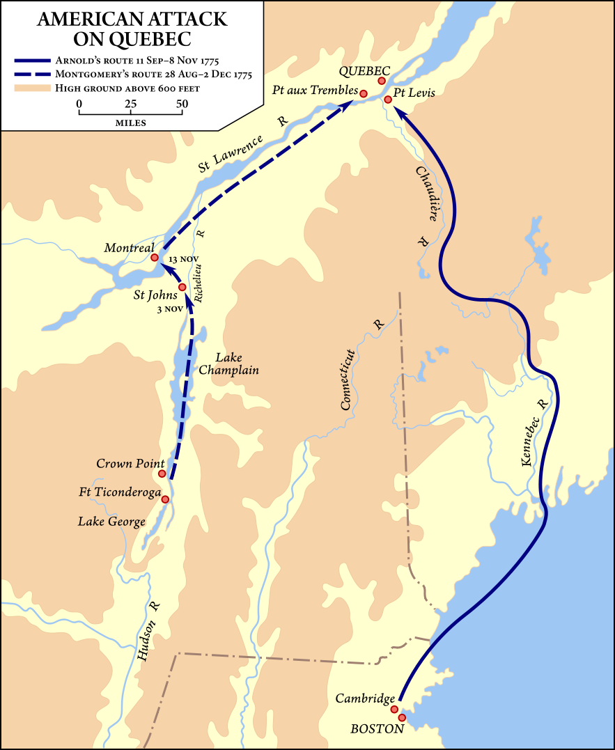
Map showing the routes taken by the Benedict Arnold and Richard Montgomery expeditions into Quebec as part of the American Invasion of Canada (1775). Cette image vectorielle a été créée avec Inkscape, puis modifiée à la main . |
| Date | Vectorized September 19–20, 2008 |
| Source | Vector version of Image:American quebec 1775.jpg, from American Military History, United States Army Center of Military History, 1989, courtesy of the University of Texas Libraries, The University of Texas at Austin. |
| Auteur | United States Army Center of Military History, vector version by Fvasconcellos (d · contributions) |
| Autorisation (Réutilisation de ce fichier) |
This image is derived from a work of the U.S. government and, as such, is in the public domain. |
| Autres versions | Image:American quebec 1775.jpg |
Conditions d’utilisation
| This image is in the public domain because it contains materials that originally came from the United States Army Center of Military History, subject to the following qualification.
Note: The images of all badges, insignia, decorations and medals on the "CMH Online" web site are produced by the United States Army Institute of Heraldry and protected by Title 18, United States Code, Section 704 and the Code of Federal Regulations (32 CFR, Part 507). Permission to use these images for commercial purposes must be obtained from The Institute of Heraldry prior to their use. |

|
Historique du fichier
Cliquer sur une date et heure pour voir le fichier tel qu'il était à ce moment-là.
| Date et heure | Vignette | Dimensions | Utilisateur | Commentaire | |
|---|---|---|---|---|---|
| actuel | 21 septembre 2008 à 03:54 | | 883 × 1 077 (752 kio) | Fvasconcellos | ==Summary== {{validSVG}} {{Information |Description=Map showing the routes taken by the {{w|Benedict Arnold}} and {{w|Richard Montgomery}} expeditions into Quebec as part of the American {{w|Invasion of Canada (1775)}}.<br/> Vector version of [[:Image:Ame |
Utilisation du fichier
Les 5 pages suivantes utilisent ce fichier :
Usage global du fichier
Les autres wikis suivants utilisent ce fichier :
- Utilisation sur ca.wikipedia.org
- Utilisation sur da.wikipedia.org
- Utilisation sur de.wikipedia.org
- Utilisation sur en.wikipedia.org
- Utilisation sur es.wikipedia.org
- Utilisation sur he.wikipedia.org
- Utilisation sur id.wikipedia.org
- Utilisation sur it.wikipedia.org
- Utilisation sur ja.wikipedia.org
- Utilisation sur ko.wikipedia.org
- Utilisation sur ms.wikipedia.org
- Utilisation sur pt.wikipedia.org
- Utilisation sur ro.wikipedia.org
- Utilisation sur ru.wikipedia.org
- Utilisation sur sh.wikipedia.org
- Utilisation sur uk.wikipedia.org
- Utilisation sur www.wikidata.org
- Utilisation sur zh.wikipedia.org