
Fichier:Alicante-loc.svg

Taille de cet aperçu PNG pour ce fichier SVG : 593 × 599 pixels. Autres résolutions : 237 × 240 pixels | 475 × 480 pixels | 760 × 768 pixels | 1 013 × 1 024 pixels | 2 026 × 2 048 pixels | 2 134 × 2 157 pixels.
Fichier d’origine (Fichier SVG, nominalement de 2 134 × 2 157 pixels, taille : 275 kio)
Ce fichier et sa description proviennent de Wikimedia Commons.
Description
| Description |
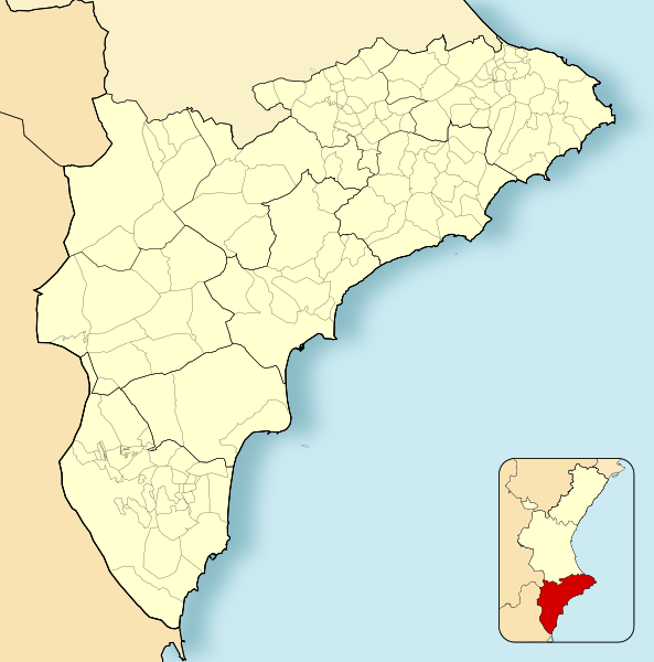
English: Location map of Province of Alicante
Equirectangular projection, N/S stretching 130 %. Geographic limits of the map:
Español: Mapa de localización de la Provincia de Alicante
Proyección equirrectangular (cilíndrica equidistante), N/S estirada 130 %. Límites geográficos del mapa:
|
|
| Date | ||
| Source | Travail personnel basé sur : EspañaLoc.svg | |
| Auteur | Miguillen | |
| SVG information | Cette carte a été créée avec Adobe Illustrator, et avec Inkscape.
|
Conditions d’utilisation
Miguillen, en tant que détenteur des droits d’auteur sur cette œuvre, la publie sous la licence suivante :
Ce fichier est disponible selon les termes de la licence Creative Commons Attribution – Partage dans les Mêmes Conditions 3.0 (non transposée).
Attribution: Miguillen
- Vous êtes libre :
- de partager – de copier, distribuer et transmettre cette œuvre
- d’adapter – de modifier cette œuvre
- Sous les conditions suivantes :
- paternité – Vous devez donner les informations appropriées concernant l'auteur, fournir un lien vers la licence et indiquer si des modifications ont été faites. Vous pouvez faire cela par tout moyen raisonnable, mais en aucune façon suggérant que l’auteur vous soutient ou approuve l’utilisation que vous en faites.
- partage à l’identique – Si vous modifiez, transformez, ou vous basez sur cette œuvre, vous devez distribuer votre contribution sous la même licence ou une licence compatible avec celle de l’original.
Historique du fichier
Cliquer sur une date et heure pour voir le fichier tel qu'il était à ce moment-là.
| Date et heure | Vignette | Dimensions | Utilisateur | Commentaire | |
|---|---|---|---|---|---|
| actuel | 8 décembre 2010 à 17:46 | | 2 134 × 2 157 (275 kio) | Miguillen | colores |
| 16 novembre 2010 à 18:58 |  | 2 134 × 2 157 (216 kio) | Miguillen | == {{int:filedesc}} == {{Information |Description={{en|Location map of Province of Alicante}} Equirectangular projection, N/S stretching 130 %. Geographic limits of the map: * N: ° N * S: ° N * W: ° O * E: ° E {{es|M |
Utilisation du fichier
La page suivante utilise ce fichier :
Usage global du fichier
Les autres wikis suivants utilisent ce fichier :
- Utilisation sur ar.wikipedia.org
- Utilisation sur ast.wikipedia.org
- Utilisation sur ba.wikipedia.org
- Utilisation sur ceb.wikipedia.org
- Utilisation sur en.wikipedia.org
- Elche
- Guardamar del Segura
- Xàbia
- Altea
- Novelda
- Villena
- Santa Pola
- Calpe
- Ibi, Spain
- Cocentaina
- Benejúzar
- Muro de Alcoy
- Pinoso
- Pilar de la Horadada
- La Vall de Gallinera
- Moraira
- Lucentum
- Villamartin
- Benissa
- Teulada, Spain
- Lorcha, Spain
- Jalón
- Bigastro
- Callosa de Segura
- San Miguel de Salinas
- Agost
- Busot
- Gorga, Spain
- Mutxamel
- Salinas, Alicante
- Sax, Alicante
- Pedreguer
- 1992 UCI Road World Championships
- Module:Location map/data/Spain Province of Alicante/doc
- University of Orihuela
- Lycée Français d'Alicante
- Camino de Beniel
- Module:Location map/data/Spain Province of Alicante
- Barbarroja (Alicante)
- La Murada
- 2022 Segunda División RFEF play-offs
- Utilisation sur eo.wikipedia.org
Voir davantage sur l’utilisation globale de ce fichier.