
Fichier:Alexandria Winchester 1776.jpg
Fichier d’origine (1 208 × 704 pixels, taille du fichier : 247 kio, type MIME : image/jpeg)
Ce fichier et sa description proviennent de Wikimedia Commons.
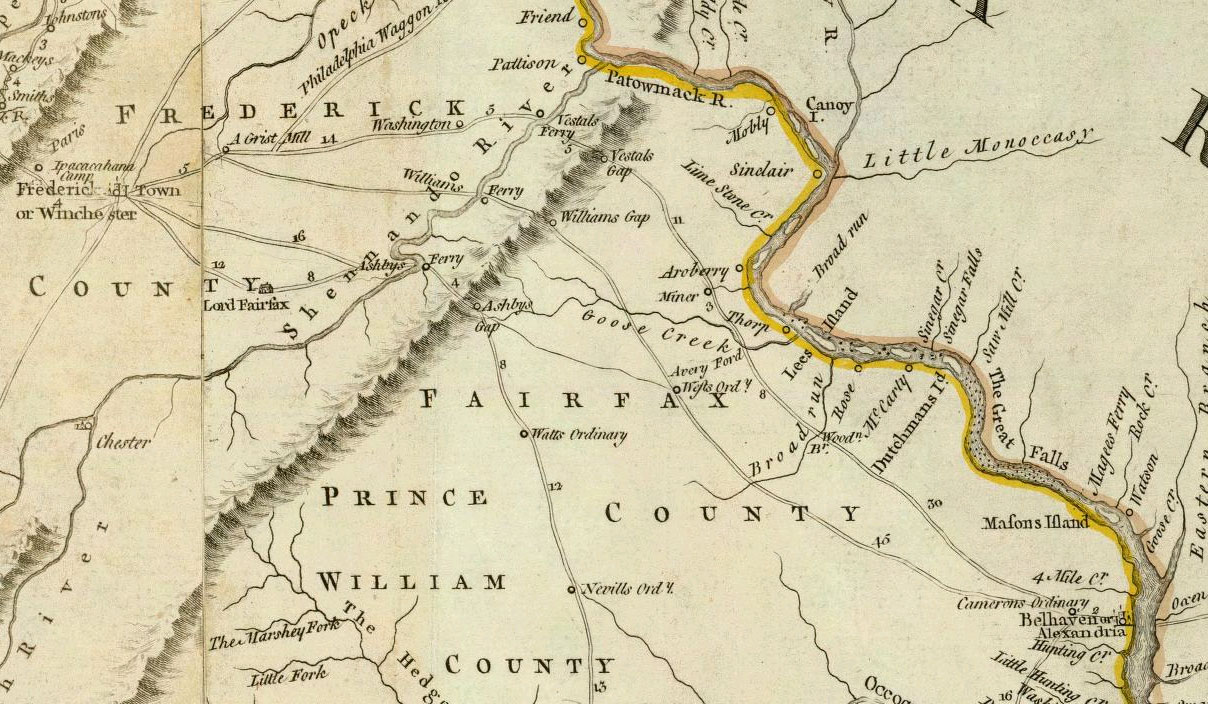
Description
- Author: Jefferys, Thomas
- Date: 1776
- Title: A Map of the most Inhabited part of Virginia containing the whole province of Maryland with Part of Pensilvania, New Jersey and North Carolina.
- Drawn by Joshua Fry & Peter Jefferson in 1775.
- Publisher: London: Sayer and Bennett
- Published in: The American Atlas: Or, A Geographical Description Of The Whole Continent Of America.
|
Cette œuvre est également dans le domaine public dans tous les pays pour lesquels le droit d’auteur a une durée de vie de 70 ans ou moins après la mort de l’auteur.
| |
| Ce fichier a été identifié comme étant exempt de restrictions connues liées au droit d’auteur, y compris tous les droits connexes et voisins. | |
Historique du fichier
Cliquer sur une date et heure pour voir le fichier tel qu'il était à ce moment-là.
| Date et heure | Vignette | Dimensions | Utilisateur | Commentaire | |
|---|---|---|---|---|---|
| actuel | 4 juillet 2007 à 03:09 | | 1 208 × 704 (247 kio) | NE2 | {{PD-old}} This is a portion of [http://www.davidrumsey.com/maps4596.html a map]: *Author: Jefferys, Thomas *Date: 1776 *Title: A Map of the most Inhabited part of Virginia containing the whole province of Maryland with Part of Pensilvania, New Jersey and |
Utilisation du fichier
La page suivante utilise ce fichier :
Usage global du fichier
Les autres wikis suivants utilisent ce fichier :
- Utilisation sur en.wikipedia.org
- Utilisation sur es.wikipedia.org
- Utilisation sur it.wikipedia.org