
Fichier:1940 Boston streetcar lines.png
Taille de cet aperçu : 550 × 600 pixels. Autres résolutions : 220 × 240 pixels | 440 × 480 pixels | 704 × 768 pixels | 939 × 1 024 pixels | 1 797 × 1 960 pixels.
Fichier d’origine (1 797 × 1 960 pixels, taille du fichier : 373 kio, type MIME : image/png)
Ce fichier et sa description proviennent de Wikimedia Commons.
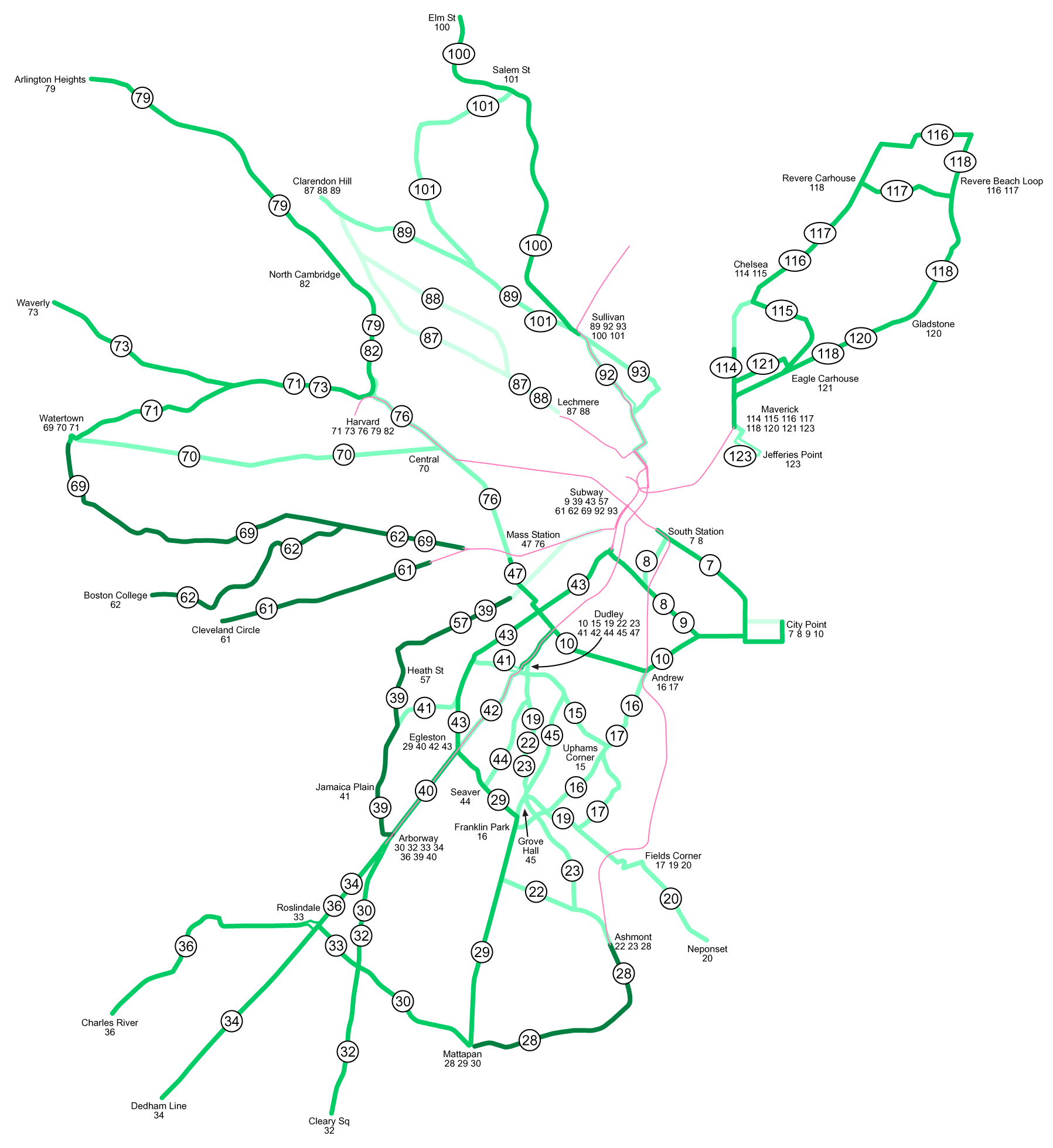
| Description | Boston Elevated Railway streetcar lines in 1940. Lighter lines were abandoned earlier; the darkest ones still existed in 1969. |
| Date | 19 mai 2005 (date de téléversement originale) |
| Source | Travail personnel |
| Auteur | SPUI |
| Cette œuvre a été placée dans le domaine public par son auteur, SPUI. Ceci s’applique dans le monde entier. Dans certains pays, ceci peut ne pas être possible ; dans ce cas : |
Historique du fichier
Cliquer sur une date et heure pour voir le fichier tel qu'il était à ce moment-là.
| Date et heure | Vignette | Dimensions | Utilisateur | Commentaire | |
|---|---|---|---|---|---|
| actuel | 5 décembre 2022 à 10:33 | | 1 797 × 1 960 (373 kio) | Lexande | Corrections around Roslindale, South Station, and Chelsea/East Boston |
| 8 juillet 2016 à 23:46 |  | 1 797 × 1 960 (331 kio) | Whoop whoop pull up | Rm Atlantic Avenue Elevated (discontinued in 1938) and Huntington Avenue Subway (not opened until 1941), and fixed spacing of Andrew route numbers. | |
| 19 mai 2005 à 08:11 |  | 1 797 × 1 960 (159 kio) | SPUI~commonswiki | {{spuimap}} Boston Elevated Railway streetcar lines in 1940. category:Boston subwaycategory:railroad maps |
Utilisation du fichier
La page suivante utilise ce fichier :
Usage global du fichier
Les autres wikis suivants utilisent ce fichier :
- Utilisation sur en.wikipedia.org
- Utilisation sur nl.wikipedia.org
- Utilisation sur www.wikidata.org