
Fichier:青ヶ島 2.jpg

Taille de cet aperçu : 520 × 600 pixels. Autres résolutions : 208 × 240 pixels | 416 × 480 pixels | 666 × 768 pixels | 887 × 1 024 pixels | 2 438 × 2 813 pixels.
Fichier d’origine (2 438 × 2 813 pixels, taille du fichier : 2,72 Mio, type MIME : image/jpeg)
Ce fichier et sa description proviennent de Wikimedia Commons.
Description
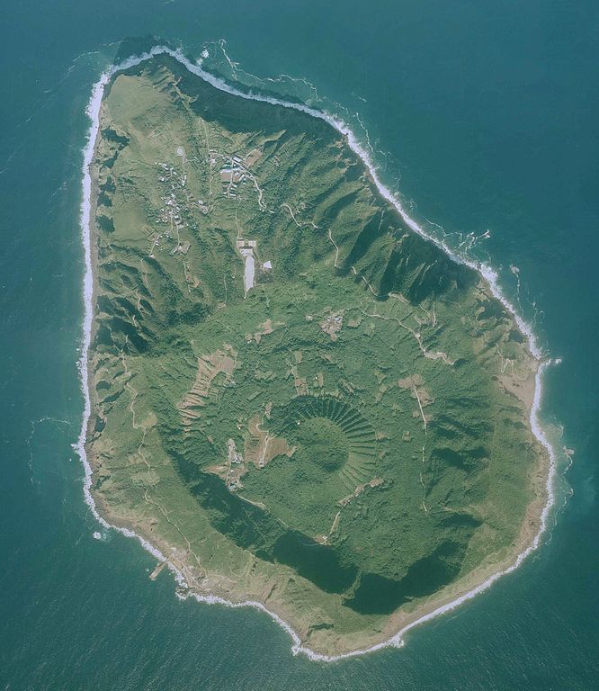
| Description |
日本語: 青ヶ島の航空写真。国土地理院の地図・空中写真閲覧サービスより
|
| Date | |
| Source | http://mapps.gsi.go.jp/maplibSearch.do#1 |
| Auteur | 国土地理院 |
Conditions d’utilisation

|
Le détenteur des droits d’auteur de ce fichier, Ministry of Land, Infrastructure, Transport and Tourism, autorise n’importe qui à l’utiliser pour n’importe quelle utilisation, pourvu que le détenteur des droits d’auteur soit correctement attribué. La redistribution, les œuvres dérivées, l’utilisation commerciale et toutes les autres utilisations sont autorisées. |
Attribution:
National Land Image Information (Color Aerial Photographs), created by Ministry of Land, Infrastructure, Transport and Tourism, distributed by Geospatial Information Authority of Japan
|

Historique du fichier
Cliquer sur une date et heure pour voir le fichier tel qu'il était à ce moment-là.
| Date et heure | Vignette | Dimensions | Utilisateur | Commentaire | |
|---|---|---|---|---|---|
| actuel | 28 mai 2017 à 10:18 | | 2 438 × 2 813 (2,72 Mio) | Nux-vomica 1007 | User created page with UploadWizard |
Utilisation du fichier
La page suivante utilise ce fichier :
Usage global du fichier
Les autres wikis suivants utilisent ce fichier :
- Utilisation sur en.wikipedia.org
- Utilisation sur ja.wikivoyage.org
- Utilisation sur ku.wikipedia.org
- Utilisation sur uk.wikipedia.org