
Fichier:Seattle downtown neighborhoods.jpg
Taille de cet aperçu : 701 × 599 pixels. Autres résolutions : 281 × 240 pixels | 561 × 480 pixels | 898 × 768 pixels | 1 242 × 1 062 pixels.
Fichier d’origine (1 242 × 1 062 pixels, taille du fichier : 301 kio, type MIME : image/jpeg)
Ce fichier et sa description proviennent de Wikimedia Commons.
Description
| Description |
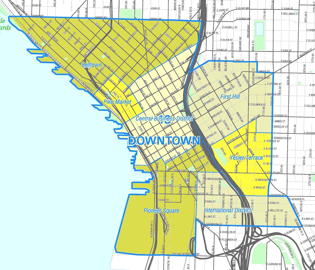
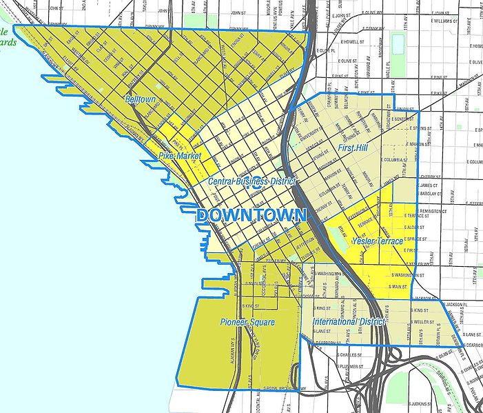
English: Map of Seattle's Downtown neighborhoods. Like the other maps from the Seattle City Clerk's Neighborhood Map Atlas, this is not an official map; in particular, borders are not official.
|
|
| Date | Retrieved from Seattle City Clerk's Neighborhood Map Atlas November 25, 2004 | |
| Source | Image from the Downtown map, map NN 1240 from Seattle City Clerk's Neighborhood Map Atlas. | |
| Auteur | Office of the Seattle City Clerk | |
| Autorisation (Réutilisation de ce fichier) |
PD-Seattle-Neighborhood-Atlas. Also, prior to that status being clarified, we had: |
Conditions d’utilisation
| This file is in the public domain because it is part of the Seattle Neighborhood Atlas, which the Seattle Clerk's Office has placed in the public domain.
While these maps are used by the clerk's office as a way to increase consistency in their own use of geographic names, the atlas is "not designed or intended as an 'official' City of Seattle neighborhood map, and has no official status." (See About Maps, Seattle Clerk's Office.) |

|
| This work has been released into the public domain by its copyright holder, Seattle Clerk's Office. This applies worldwide. Dans certains pays, ceci peut ne pas être possible ; dans ce cas : Seattle Clerk's Office accorde à toute personne le droit d’utiliser cette œuvre dans n’importe quel but, sans aucune condition, sauf celles requises par la loi.
|
| Annotations | Cette image est annotée : Voir les annotations sur Wikimedia Commons |


Historique du fichier
Cliquer sur une date et heure pour voir le fichier tel qu'il était à ce moment-là.
| Date et heure | Vignette | Dimensions | Utilisateur | Commentaire | |
|---|---|---|---|---|---|
| actuel | 1 avril 2008 à 21:28 | | 1 242 × 1 062 (301 kio) | Jmabel | ==Summary== {{Information |Description=Unofficial map of the neighborhoods in downtown Seattle. {{Seattle Neighborhood Atlas disclaimer}} |Source=Image from the [http://clerk.ci.seattle.wa.us/~publ |
Utilisation du fichier
La page suivante utilise ce fichier :
Usage global du fichier
Les autres wikis suivants utilisent ce fichier :
- Utilisation sur en.wikipedia.org
- Utilisation sur es.wikipedia.org
- Utilisation sur it.wikipedia.org
- Utilisation sur www.wikidata.org