
Fichier:SanNicolas,Pangasinanjf9111 11.JPG

Taille de cet aperçu : 800 × 600 pixels. Autres résolutions : 320 × 240 pixels | 640 × 480 pixels | 1 024 × 768 pixels | 1 280 × 960 pixels | 2 560 × 1 920 pixels | 4 608 × 3 456 pixels.
Fichier d’origine (4 608 × 3 456 pixels, taille du fichier : 6,41 Mio, type MIME : image/jpeg)
Ce fichier et sa description proviennent de Wikimedia Commons.
Description
| Description |
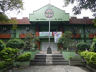
English: Municipal Hall Complex of San Nicolas, Pangasinan San Nicolas-Santa Fe Road (San Nicolas) Tayug-San Nicolas Road (San Nicolas) to San Nicolas-Natividad Road to San Nicolas-Santa Fe Road to Villaverde, Nueva Vizcaya from Santa Maria-Tayug Road to Rosales-Santa Maria Road surrounded by Caraballo Mountains and served by the Agno River, Category:Sitios and puroks of the Philippines List of barangays in Pangasinan, Barangays of Pangasinan, Barangay Legaspi, Tayug, Pangasinan 16.0476, 120.7403 Tayug, Pangasinan bounded by Category:Sitios and puroks of the Philippines List of barangays in Pangasinan, Barangays of Pangasinan, Barangays of Pangasinan, Barangays Nagkaysa, San Nicolas, Pangasinan 16.0684, 120.7612 Casaratan, San Nicolas, Pangasinan 16.0700, 120.7571 Poblacion West, San Nicolas, Pangasinan 16.0742, 120.7564 Poblacion East, San Nicolas, Pangasinan 16.0739, 120.7622 Cabitnongan, San Nicolas, Pangasinan 16.0767, 120.7709 Calaocan, San Nicolas, Pangasinan 16.0824, 120.7817 Santa Maria West, San Nicolas, Pangasinan 16.0968, 120.7931 Santa Maria East, San Nicolas, Pangasinan 16.1142, 120.8059 Cacabugaoan, San Nicolas, Pangasinan 16.1019, 120.8358 San Nicolas, Pangasinan accessed also from Highway from Pangasinan to Nueva Ecija Verde trail Nueva Ecija-Pangasinan Road Pangasinan-Nueva Ecija Interprovincial Road Latitude: 15°39'24.84" Longitude: 120°49'35.76" Villa Verde Road Villaverde Trail short cut linking Pangasinan to Nueva Vizcaya, specifcially linking Santa Fe, Nueva Vizcaya to the upland Barangays Malico 16.1401, 120.8284 and Fianza 16.1531, 120.8099 San Nicolas, Pangasinan accessed from or along Carmen Junction-Manat Road, KM 172+ (-289) - KM 189+250 and from MacArthur Highway (Rosales, Pangasinan section) MacArthur Highway or Manila North Road) Philippine highway network.) |
| Date | |
| Source | Travail personnel |
| Auteur | Ramon FVelasquez |
Conditions d’utilisation
Moi, en tant que détenteur des droits d’auteur sur cette œuvre, je la publie sous la licence suivante :
Ce fichier est disponible selon les termes de la licence Creative Commons Attribution – Partage dans les Mêmes Conditions 3.0 (non transposée).
- Vous êtes libre :
- de partager – de copier, distribuer et transmettre cette œuvre
- d’adapter – de modifier cette œuvre
- Sous les conditions suivantes :
- paternité – Vous devez donner les informations appropriées concernant l'auteur, fournir un lien vers la licence et indiquer si des modifications ont été faites. Vous pouvez faire cela par tout moyen raisonnable, mais en aucune façon suggérant que l’auteur vous soutient ou approuve l’utilisation que vous en faites.
- partage à l’identique – Si vous modifiez, transformez, ou vous basez sur cette œuvre, vous devez distribuer votre contribution sous la même licence ou une licence compatible avec celle de l’original.
Historique du fichier
Cliquer sur une date et heure pour voir le fichier tel qu'il était à ce moment-là.
| Date et heure | Vignette | Dimensions | Utilisateur | Commentaire | |
|---|---|---|---|---|---|
| actuel | 14 août 2013 à 12:59 | | 4 608 × 3 456 (6,41 Mio) | Ramon FVelasquez | User created page with UploadWizard |
Utilisation du fichier
La page suivante utilise ce fichier :
Usage global du fichier
Les autres wikis suivants utilisent ce fichier :
- Utilisation sur bcl.wikipedia.org
- Utilisation sur cbk-zam.wikipedia.org
- Utilisation sur ilo.wikipedia.org
- Utilisation sur it.wikipedia.org
- Utilisation sur ka.wikipedia.org
- Utilisation sur ms.wikipedia.org
- Utilisation sur pag.wikipedia.org
- Utilisation sur pam.wikipedia.org
- Utilisation sur pt.wikipedia.org
- Utilisation sur tl.wikipedia.org
- Utilisation sur www.wikidata.org