
Fichier:Map RiviereDesRemparts.jpg
Taille de cet aperçu : 701 × 599 pixels. Autres résolutions : 281 × 240 pixels | 562 × 480 pixels | 898 × 768 pixels | 1 198 × 1 024 pixels | 2 396 × 2 048 pixels | 3 047 × 2 605 pixels.
Fichier d’origine (3 047 × 2 605 pixels, taille du fichier : 1,28 Mio, type MIME : image/jpeg)
Ce fichier et sa description proviennent de Wikimedia Commons.
Description
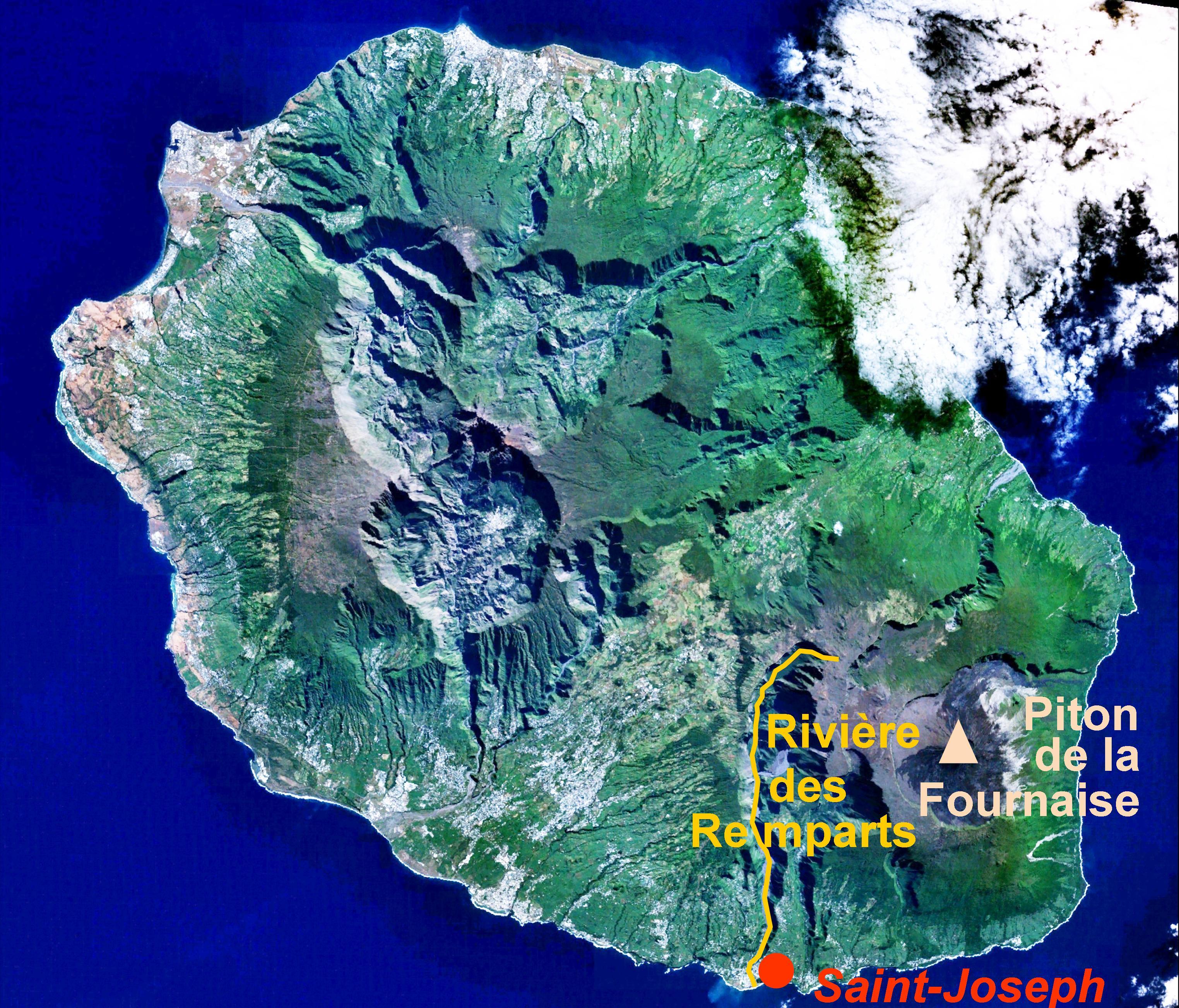
| Description | location of the Rivière des Remparts on a satellite view of Réunion island |
| Date | caption added by User:B.navez on 24 JUN 2006 |
| Source | caption added to Image:Reunion 21.12S 55.51E.jpg |
| Auteur | NASA |
| Autorisation (Réutilisation de ce fichier) |
PD |
Conditions d’utilisation
| Ce fichier provient de la NASA. Sauf exception, les documents créés par la NASA ne sont pas soumis à copyright. Pour plus d'informations, voir la politique de copyright de la NASA. | ||
 |
Attention :
|
Historique du fichier
Cliquer sur une date et heure pour voir le fichier tel qu'il était à ce moment-là.
| Date et heure | Vignette | Dimensions | Utilisateur | Commentaire | |
|---|---|---|---|---|---|
| actuel | 24 juin 2006 à 13:40 | | 3 047 × 2 605 (1,28 Mio) | B.navez | the same picture without black strips |
| 24 juin 2006 à 13:30 |  | 3 072 × 2 622 (1,29 Mio) | B.navez | {{Information| |Description= location of the ''Rivière des Remparts'' on a satellite view of Réunion island |Source= caption added to Image:Reunion 21.12S 55.51E.jpg |Date= caption added by User:B.navez on 24 JUN 2006 |Author= NASA |Permission= |
Utilisation du fichier
La page suivante utilise ce fichier :
Usage global du fichier
Les autres wikis suivants utilisent ce fichier :
- Utilisation sur ceb.wikipedia.org
- Utilisation sur en.wikipedia.org
- Utilisation sur www.wikidata.org