
Fichier:Holborn, John Watkins Plaza, London School of Economics - geograph.org.uk - 668683.jpg
Pas de plus haute résolution disponible.
Holborn,_John_Watkins_Plaza,_London_School_of_Economics_-_geograph.org.uk_-_668683.jpg (640 × 480 pixels, taille du fichier : 103 kio, type MIME : image/jpeg)
Ce fichier et sa description proviennent de Wikimedia Commons.
Description
| Description |
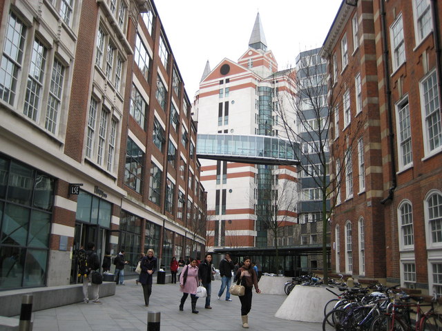
English: Holborn: John Watkins Plaza, London School of Economics This plaza, which is off Portugal Street, was designed to replicate the open space of a square in an Italian city, and to achieve one of the LSE's key aspirations, that of matching quality of environment with quality of teaching and research. It was named after Professor of Philosophy John Watkins who taught at the LSE from 1950 to 1989, later becoming Emeritus Professor until his death in 1999. The plaza was opened in June 2003. The building on the left is the Lionel Robbins Building, while The Lakatos Building is on the right. |
| Date | |
| Source | From geograph.org.uk |
| Auteur | Nigel Cox |
| Attribution (imposé par la licence) | Nigel Cox / Holborn: John Watkins Plaza, London School of Economics / |
| Lieu de la prise de vue | | Voir cet endroit et d’autres images sur : OpenStreetMap |
|---|
_heading:112.00&language=fr)
| Position de l'objet | | Voir cet endroit et d’autres images sur : OpenStreetMap |
|---|
_heading:112.00&language=fr)
Conditions d’utilisation

|
Cette image provient de la collection du projet Geograph British Isles. Pour obtenir les coordonnées du photographe, veuillez consulter cette page de description de l'image sur le site du projet. Les droits d'auteurs sur cette image sont détenus par Nigel Cox ; l'image est placée sous une licence Creative Commons avec mention de paternité et partage à l'identique (CC-By-SA) en version 2.0.
|
Ce fichier est disponible selon les termes de la licence Creative Commons Attribution – Partage dans les Mêmes Conditions 2.0 Générique
Attribution: Nigel Cox
- Vous êtes libre :
- de partager – de copier, distribuer et transmettre cette œuvre
- d’adapter – de modifier cette œuvre
- Sous les conditions suivantes :
- paternité – Vous devez donner les informations appropriées concernant l'auteur, fournir un lien vers la licence et indiquer si des modifications ont été faites. Vous pouvez faire cela par tout moyen raisonnable, mais en aucune façon suggérant que l’auteur vous soutient ou approuve l’utilisation que vous en faites.
- partage à l’identique – Si vous modifiez, transformez, ou vous basez sur cette œuvre, vous devez distribuer votre contribution sous la même licence ou une licence compatible avec celle de l’original.
Historique du fichier
Cliquer sur une date et heure pour voir le fichier tel qu'il était à ce moment-là.
| Date et heure | Vignette | Dimensions | Utilisateur | Commentaire | |
|---|---|---|---|---|---|
| actuel | 7 février 2011 à 20:41 | | 640 × 480 (103 kio) | GeographBot | == {{int:filedesc}} == {{Information |description={{en|1=Holborn: John Watkins Plaza, London School of Economics This plaza, which is off Portugal Street, was designed to replicate the open space of a square in an Italian city, and to achieve one of the L |
Utilisation du fichier
La page suivante utilise ce fichier :
Usage global du fichier
Les autres wikis suivants utilisent ce fichier :
- Utilisation sur en.wikipedia.org
- Utilisation sur zh.wikipedia.org