
Fichier:Fonseca gulf.jpg

Taille de cet aperçu : 615 × 600 pixels. Autres résolutions : 246 × 240 pixels | 492 × 480 pixels | 640 × 624 pixels.
Fichier d’origine (640 × 624 pixels, taille du fichier : 109 kio, type MIME : image/jpeg)
Ce fichier et sa description proviennent de Wikimedia Commons.
Description
| Description |
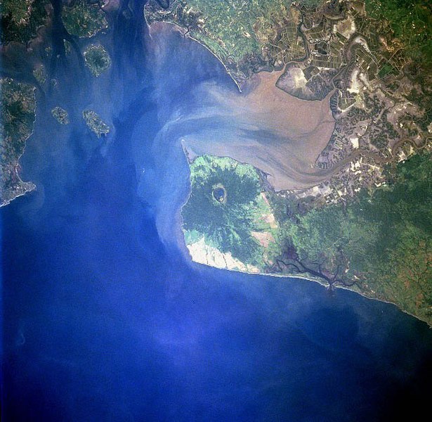
Gulf of Fonseca, El Salvador, Honduras, Nicaragua |
| Date | |
| Source | eol.jsc.nasa.gov |
| Auteur | NASA |
| Autres versions |
.jpg)
Conditions d’utilisation
| Ce fichier provient de la NASA. Sauf exception, les documents créés par la NASA ne sont pas soumis à copyright. Pour plus d'informations, voir la politique de copyright de la NASA. | ||
 |
Attention :
|
Historique du fichier
Cliquer sur une date et heure pour voir le fichier tel qu'il était à ce moment-là.
| Date et heure | Vignette | Dimensions | Utilisateur | Commentaire | |
|---|---|---|---|---|---|
| actuel | 22 novembre 2022 à 11:40 | | 640 × 624 (109 kio) | SteinsplitterBot | Bot: Image rotated by 270° |
| 10 décembre 2005 à 06:10 |  | 631 × 640 (110 kio) | Thuresson | Gulf of Fonseca, El Salvador, Honduras, Nicaragua - July 1997 *Image courtesy of the Image Science & Analysis Laboratory, NASA Johnson Space Center. *Source: [http://eol.jsc.nasa.gov/sseop/EFS/photoinfo.pl?PHOTO=STS094-723-83 eol.jsc.nasa.gov] *Photo #: |
Utilisation du fichier
La page suivante utilise ce fichier :
Usage global du fichier
Les autres wikis suivants utilisent ce fichier :
- Utilisation sur de.wikipedia.org
- Utilisation sur el.wikipedia.org
- Utilisation sur en.wikipedia.org
- Utilisation sur eo.wikipedia.org
- Utilisation sur es.wikipedia.org
- Utilisation sur gl.wikipedia.org
- Utilisation sur it.wikipedia.org
- Utilisation sur ja.wikipedia.org
- Utilisation sur lt.wikipedia.org
- Utilisation sur nl.wikipedia.org
- Utilisation sur pl.wikipedia.org
- Utilisation sur pt.wikipedia.org
- Utilisation sur ru.wikipedia.org
- Utilisation sur sk.wikipedia.org
- Utilisation sur uk.wikipedia.org
- Utilisation sur www.wikidata.org