
Fichier:South Africa Western Cape relief location map.svg

Taille de cet aperçu PNG pour ce fichier SVG : 749 × 600 pixels. Autres résolutions : 300 × 240 pixels | 600 × 480 pixels | 959 × 768 pixels | 1 279 × 1 024 pixels | 2 558 × 2 048 pixels | 1 214 × 972 pixels.
Fichier d’origine (Fichier SVG, nominalement de 1 214 × 972 pixels, taille : 1,98 Mio)
Ce fichier et sa description proviennent de Wikimedia Commons.
| Description |
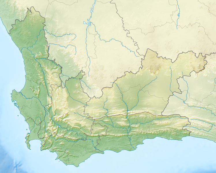
English: Relief location map of the Western Cape
Equirectangular projection, N/S stretching 118%. Geographic limits of the map:
|
| Date | |
| Source |
|
| Auteur | Htonl |
| Autorisation (Réutilisation de ce fichier) |
Moi, en tant que détenteur des droits d’auteur sur cette œuvre, je la publie sous la licence suivante : Ce fichier est disponible selon les termes de la licence Creative Commons Attribution – Partage dans les Mêmes Conditions 3.0 (non transposée).
|
| Autres versions | File:South Africa Western Cape location map.svg |
Historique du fichier
Cliquer sur une date et heure pour voir le fichier tel qu'il était à ce moment-là.
| Date et heure | Vignette | Dimensions | Utilisateur | Commentaire | |
|---|---|---|---|---|---|
| actuel | 4 janvier 2013 à 21:44 | | 1 214 × 972 (1,98 Mio) | Htonl | {{Information |Description ={{en|1=Relief location map of the Western Cape Equirectangular projection, N/S stretching 118%. Geographic limits of the map: * N: 30.25° S * S: 35.0° S * W: 17.5° E * E: 24.5° E}} |Source ... |
Utilisation du fichier
Les 30 pages suivantes utilisent ce fichier :
- Cap de Bonne-Espérance
- Col Attakwaskloof
- Col Du Toitskloof
- Col Montagu
- Col Outeniqua
- Col Robinson
- Col Swartberg
- Col de Bainskloof
- Col de Molteno
- Col de Sir Lowry
- Diepkloof
- Douze Apôtres (montagne)
- Gamkaskloof
- Grotte de Blombos
- Homme de Saldanha
- Killarney International Raceway
- Meiringspoort
- Parc national de Tsitsikamma
- Parc national des Bonteboks
- Parc national du Karoo
- Passe Cogmanskloof
- Passe de Michell
- Pinnacle Point
- Robben Island
- Réserve naturelle du Cederberg
- Réserve naturelle du Swartberg
- Saldanha Bay
- Seweweeks Poort
- Île de Dassen
- Modèle:Géolocalisation/Cap-Occidental
Usage global du fichier
Les autres wikis suivants utilisent ce fichier :
- Utilisation sur ar.wikipedia.org
- Utilisation sur ban.wikipedia.org
- Utilisation sur be.wikipedia.org
- Utilisation sur bg.wikipedia.org
- Utilisation sur ceb.wikipedia.org
- Utilisation sur de.wikipedia.org
- Tafelbucht
- Boulders Beach
- Saldanha Bay
- Montagu-Pass
- Wikipedia:Kartenwerkstatt/Positionskarten/Afrika
- Dyer Island (Südafrika)
- False Bay
- Vorlage:Positionskarte Südafrika Westkap
- Duiker Island
- Dassen Island
- Benutzer:Olga Ernst/Walker Bay (Südafrika)
- Walker Bay (Südafrika)
- Matroosberg
- Still Bay
- Sankt-Helena-Bucht
- Bergwerk Steenkampskraal
- Utilisation sur en.wikipedia.org
- Stellenbosch
- Cederberg
- False Bay
- Chapman's Peak
- Blombos Cave
- Dassen Island
- Rondevlei Nature Reserve
- Seal Island, South Africa
- Marloth Nature Reserve
- Karoo National Park
- Dimension Data Pro-Am
- BOS 400
- De Hoop Nature Reserve
- Duiker Island
- Hex River Mountains
- Arniston (East Indiaman)
- Boosmansbos Wilderness Area
- Johanna (East Indiaman)
- Module:Location map/data/South Africa Western Cape/doc
- Coca-Cola Charity Championship
- Grootrivier Pass
- Akkedisberg Pass
- Attakwaskloof Pass
Voir davantage sur l’utilisation globale de ce fichier.