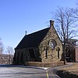
Liste des lieux patrimoniaux du comté de Hants
Cet article recense les lieux patrimoniaux du comté de Hants en Nouvelle-Écosse inscrit au répertoire des lieux patrimoniaux du Canada, qu'ils soient de niveau provincial, fédéral ou municipal.
Liste[modifier | modifier le code]
| [1] | Lieu patrimonial | Illustration | Municipalité | Adresse | Coordonnées | No | Constr. | Prot.[2] | Rec. | Notes |
|---|---|---|---|---|---|---|---|---|---|---|
| P | Sangster Inn | 
|
Falmouth | 444 Sangster Bridge Road | 44.9577 -64.2003 |
7015 | Provincially Registered Property | 1991 | ||
| F | Gare ferroviaire du Canadien Pacifique | 
|
Hantsport | 15 Station Street | 45.069 -64.176 |
4554 | 1943 | Heritage Railway Station | 1992 | [3] |
| P | Gare de Hantsport | 
|
Hantsport | 15 Station Road | 45.0687 -64.1764 |
7816 | 1944 | Provincially Registered Property | 1995 | [4] |
| M | Kempt Shore Presbyterian Church | 
|
Kempt Shore | 5659 Highway 215 | 45.1274 -64.1942 |
11815 | 1865 | Municipally Registered Property | 1995 | |
| M | All Saints Anglican Church | 
|
Leminster | 652 New Ross Road | 44.8205 -64.2855 |
11898 | 1871 | Municipally Registered Property | 1993 | |
| P | Lawrence House | 
|
Maitland | 8660 Highway Number 215 | 45.3222 -63.5025 |
1274 | 1880 | Provincially Registered Property | 1983 | |
| P | Springhurst | 
|
Maitland | 8557 No. 215 Highway | 45.3249 -63.5074 |
7320 | 1870 | Provincially Registered Property | 1989 | |
| P | Uniacke Estate Archaeological Site | 
|
Mount Uniacke | Highway No. 1 | 44.9016 -63.8451 |
7302 | Special Place | 1992 | ||
| P | Uniacke House | 
|
Mount Uniacke | Highway No. 1 | 44.9016 -63.8451 |
3076 | 1815 | Provincially Registered Property | 1983 | |
| M | Dimock House | 
|
Scotch Village | 744 Highway 236 | 45.0488 -64.0107 |
11880 | Municipally Registered Property | 2000 | ||
| P | Smith-Duckenfield House | 
|
Selma | 8098 Hwy No. 215 | 45.3202 -63.5342 |
5754 | 1825 | Provincially Registered Property | 1996 | |
| F | Blockhaus | 
|
Windsor | 44.995 -64.135 |
2994 | 1750 | Classified Federal Heritage Building | 1994 | ||
| M | Christ Church | 
|
Windsor | 543 King Street | 44.9906 -64.1313 |
12032 | 1884 | Municipally Registered Property | 2009 | |
| P | Clockmaker's Inn | 
|
Windsor | 1399; King Street | 44.9798 -64.1283 |
2908 | 1894 | Provincially Registered Property | 1995 | |
| P | Convocation Hall | 
|
Windsor | 17 Kings-Edgehill Lane | 44.9826 -64.1359 |
4094 | 1867 | Provincially Registered Property | 1992 | |
| F | Fort Edward | 
|
Windsor | Water Street | 44.9952 -64.1347 |
7419 | 1750 | National Historic Site of Canada | 1920 | |
| P | Haliburton House | 
|
Windsor | 420 Clifton Avenue | 44.989 -64.1424 |
1275 | 1836 | Provincially Registered Property | 1983 | |
| F | King's College | 
|
Windsor | 1 College Street | 44.9842 -64.1309 |
16276 | 1863 | National Historic Site of Canada | 1923 | |
| M | Lawson House | 
|
Windsor | 653 King Street | 44.9889 -64.1302 |
11858 | 1898 | Municipally Registered Property | 2000 | |
| M | Old Parish Burying Ground | 
|
Windsor | 1291 King Street | 44.9809 -64.1291 |
11860 | 1776 | Municipally Registered Property | 2007 | |
| P | Richmond Hill Farm | 
|
Windsor | 664 College Road | 44.9781 -64.1521 |
6956 | Provincially Registered Property | 1991 | ||
| P | Saint John the Evangelist Roman Catholic Church | 
|
Windsor | 339 King Street | 44.9932 -64.1329 |
7269 | 1909 | Provincially Registered Property | 1998 | |
| M | Thornton | 
|
Windsor | 646 King Street | 44.9891 -64.1294 |
11877 | 1844 | Municipally Registered Property | 2000 |
Notes et références[modifier | modifier le code]
- Niveau de la désignation: F: Fédéral, P: Provincial, M: Municipal
- (fr) Répertoire canadien des lieux patrimoniaux : Manuel de normes de documentation, Annexe A : Vocabulaires contrôlés, p.59-78
(en) Canadian Register of Historic Places: Documentation Standards Handbook, Appendix A: Controlled Vocabulary, p.57-75 - Inscrite bien provincial en 1995 (Gare de Hantsport)
- Désignée gare ferroviaire patrimoniale en 1992 (Gare ferroviaire du Canadien Pacifique)
Annexes[modifier | modifier le code]
Articles connexes[modifier | modifier le code]
Liens externes[modifier | modifier le code]
Pour l'ensemble des points mentionnés sur cette page : voir sur OpenStreetMap (aide), Bing Cartes (aide) ou télécharger au format KML (aide).
- « Lieux patrimoniaux du Canada »
- « Annuaire des désignations patrimoniales fédérales », sur Parcs Canada
- (en) « Nova Scotia Register of Historic Places », sur The Nova Scotia Historic Places Initiative
