
Fichier:Yame District in Fukuoka Prefecture.png

Taille de cet aperçu : 719 × 599 pixels. Autres résolutions : 288 × 240 pixels | 576 × 480 pixels | 922 × 768 pixels | 1 081 × 901 pixels.
Fichier d’origine (1 081 × 901 pixels, taille du fichier : 42 kio, type MIME : image/png)
Ce fichier et sa description proviennent de Wikimedia Commons.
Description
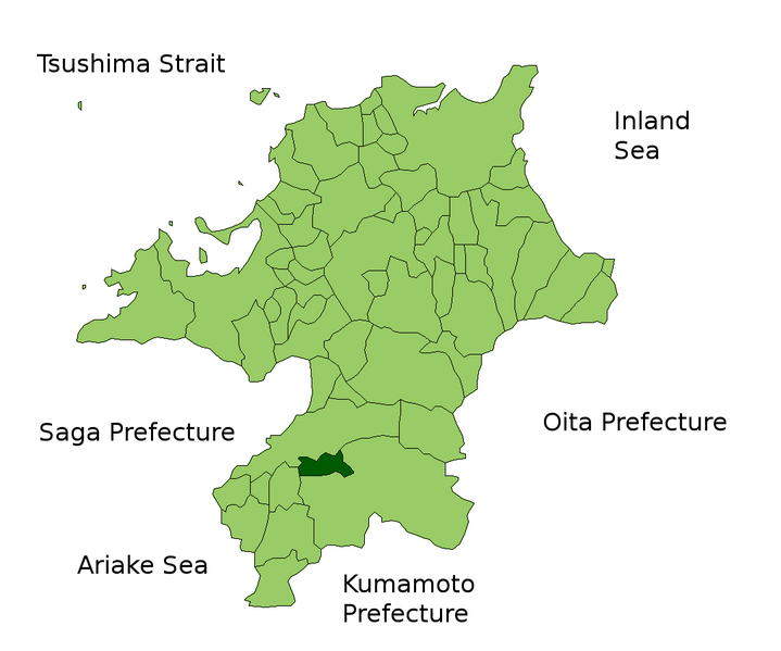
| Description | Location Map of Yame_District in Fukuoka Prefecture, Japan |
| Date | |
| Source | File:FukuokaMapCurrent.png and rework |
| Auteur | user:alberth2 |
| Autorisation (Réutilisation de ce fichier) |
PD |
Conditions d’utilisation
| Moi, propriétaire des droits d’auteur sur cette œuvre, la place dans le domaine public. Ceci s'applique dans le monde entier. Dans certains pays, ceci peut ne pas être possible ; dans ce cas : J’accorde à toute personne le droit d’utiliser cette œuvre dans n’importe quel but, sans aucune condition, sauf celles requises par la loi. |
Historique du fichier
Cliquer sur une date et heure pour voir le fichier tel qu'il était à ce moment-là.
| Date et heure | Vignette | Dimensions | Utilisateur | Commentaire | |
|---|---|---|---|---|---|
| actuel | 5 février 2010 à 16:40 | | 1 081 × 901 (42 kio) | Alberth2 | Kurogi Town, Tachibana Town, Hoshino Village, and Yabe Village were merged into Yame City. |
| 16 janvier 2010 à 11:23 |  | 1 081 × 901 (42 kio) | Alberth2 | ||
| 12 mai 2009 à 08:04 |  | 1 081 × 901 (43 kio) | Alberth2 | == Summary == {{Information |Description=Location Map of Yame_District in Fukuoka Prefecture, Japan |Source=File:FukuokaMapCurrent.png and rework |Date=May. 12th, 2009 |Author=user:alberth2 |Permission=PD |other_versions= }} == Licensing == {{PD |
Utilisation du fichier
La page suivante utilise ce fichier :
Usage global du fichier
Les autres wikis suivants utilisent ce fichier :