
Fichier:Roman Empire Map AlexanderFindlay1849.png
Fichier d’origine (2 038 × 1 828 pixels, taille du fichier : 2 Mio, type MIME : image/png)
Ce fichier et sa description proviennent de Wikimedia Commons.
Description
| Description |
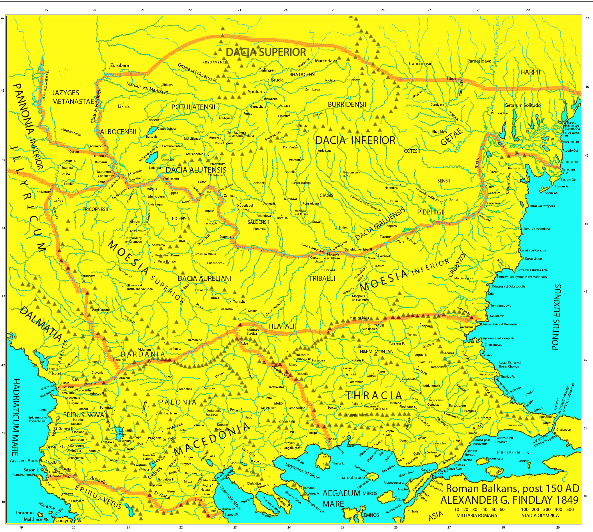
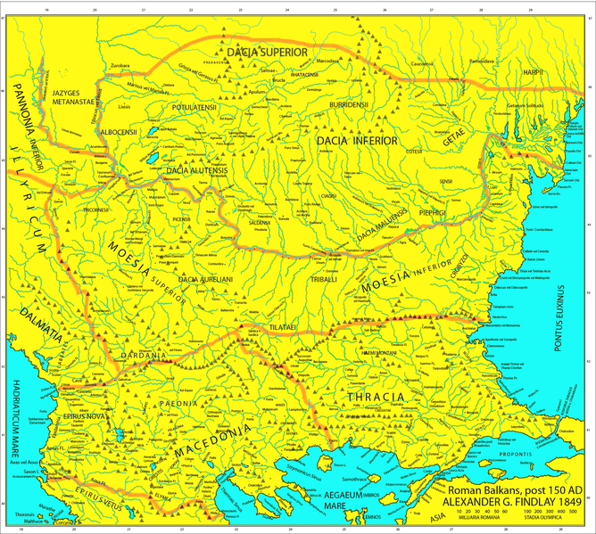
Map of the Roman provinces of Macedonia, Thracia, Illyricum, part of Pannonia Inferior, Moesia & Dacia. It is a reproduction of the 1849 Finley Map with Roman provincial borders (of about 150 AD) added to provide more information. This means that locations of many cities, tribes or other features are according to 1849 scholarship and not up to date. For example, many cities shown have not been identified yet and Findlay made arbirtrary conclusions. A great omission is that Lake Prespas are missing.
|
||
| Date | |||
| Source |
A classical atlas, to illustrate ancient geography: comprised in twenty-five maps, showing the various divisions of the world as known to the ancients : composed from the most authentic sources with an index of the ancient and modern names,Alexander G. Findlay,Publisher;Harper,1849 (Macedonia, Thracia, Illyria, Moesia, Dacia),Map X,"Comment on Map from author; Map X., & c. - Although most portions of this map are well represented, still we have a deficiency in the classical portion, as it has not been yet sufficiently examined by those who are capable of deciding and systematizing the comparative geography."
|
||
| Auteur | User:Megistias | ||
| Autorisation (Réutilisation de ce fichier) |
|
||
| Autres versions |
   |
Historique du fichier
Cliquer sur une date et heure pour voir le fichier tel qu'il était à ce moment-là.
| Date et heure | Vignette | Dimensions | Utilisateur | Commentaire | |
|---|---|---|---|---|---|
| actuel | 5 mai 2019 à 17:44 | | 2 038 × 1 828 (2 Mio) | Julieta39 | Regiones Porolissensis et Napocaoensis cum salinae et aurum excavationes |
| 24 septembre 2017 à 16:05 |  | 2 038 × 1 677 (1,9 Mio) | Julieta39 | Orthographic correction (alutensis, not alupensis and superior, not superirior) | |
| 5 novembre 2015 à 22:04 |  | 2 038 × 1 677 (1,9 Mio) | Spiridon Ion Cepleanu | Easier colours for reading the place names | |
| 25 février 2010 à 19:30 |  | 2 038 × 1 677 (1,8 Mio) | Megistias | == {{int:filedesc}} == {{Information |Description=Map of the Roman provinces of Macedonia, Thracia, Illyricum, part of Pannonia Inferior, Moesia & Dacia. It is a reproduction of the 1849 Finley Map with Roman provincial borders (of about 150 AD) added to |
Utilisation du fichier
La page suivante utilise ce fichier :
Usage global du fichier
Les autres wikis suivants utilisent ce fichier :
- Utilisation sur el.wikipedia.org
- Utilisation sur en.wikipedia.org
- Utilisation sur la.wikipedia.org
- Utilisation sur nl.wikipedia.org
- Utilisation sur pt.wikipedia.org
- Utilisation sur ro.wikipedia.org
- Utilisation sur uk.wikipedia.org