
Fichier:Rigaud Quebec location diagram.PNG
Pas de plus haute résolution disponible.
Rigaud_Quebec_location_diagram.PNG (385 × 285 pixels, taille du fichier : 82 kio, type MIME : image/png)
Ce fichier et sa description proviennent de Wikimedia Commons.
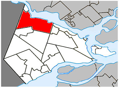
Description
| Description |
English: Location of Rigaud, Quebec |
| Date | |
| Source | Travail personnel |
| Auteur | Gordalmighty |
Conditions d’utilisation
| Moi, propriétaire des droits d’auteur sur cette œuvre, la place dans le domaine public. Ceci s'applique dans le monde entier. Dans certains pays, ceci peut ne pas être possible ; dans ce cas : J’accorde à toute personne le droit d’utiliser cette œuvre dans n’importe quel but, sans aucune condition, sauf celles requises par la loi. |
Historique du fichier
Cliquer sur une date et heure pour voir le fichier tel qu'il était à ce moment-là.
| Date et heure | Vignette | Dimensions | Utilisateur | Commentaire | |
|---|---|---|---|---|---|
| actuel | 7 avril 2009 à 22:14 | | 385 × 285 (82 kio) | Gordalmighty | map upgrade |
| 2 avril 2009 à 00:46 |  | 442 × 285 (45 kio) | Gordalmighty | Reduced image size | |
| 31 mars 2009 à 03:13 |  | 520 × 435 (27 kio) | Gordalmighty | ||
| 30 mars 2009 à 18:55 |  | 520 × 435 (26 kio) | Gordalmighty | {{Information |Description={{en|1=Location of Rigaud, Quebec}} |Source=Own work by uploader |Author=Gordalmighty |Date=2009-03-30 |Permission= |other_versions= }} <!--{{ImageUpload|full}}--> Category:Montérégie [[Category:Riga |
Utilisation du fichier
Aucune page n’utilise ce fichier.
Usage global du fichier
Les autres wikis suivants utilisent ce fichier :
- Utilisation sur en.wikipedia.org
- Utilisation sur es.wikipedia.org
- Utilisation sur fa.wikipedia.org
- Utilisation sur www.wikidata.org
- Utilisation sur zh.wikipedia.org