
Fichier:Mihama NPP 1975.jpg
Taille de cet aperçu : 600 × 600 pixels. Autres résolutions : 240 × 240 pixels | 480 × 480 pixels | 768 × 768 pixels | 1 155 × 1 155 pixels.
Fichier d’origine (1 155 × 1 155 pixels, taille du fichier : 239 kio, type MIME : image/jpeg)
Ce fichier et sa description proviennent de Wikimedia Commons.
Description
| Description |
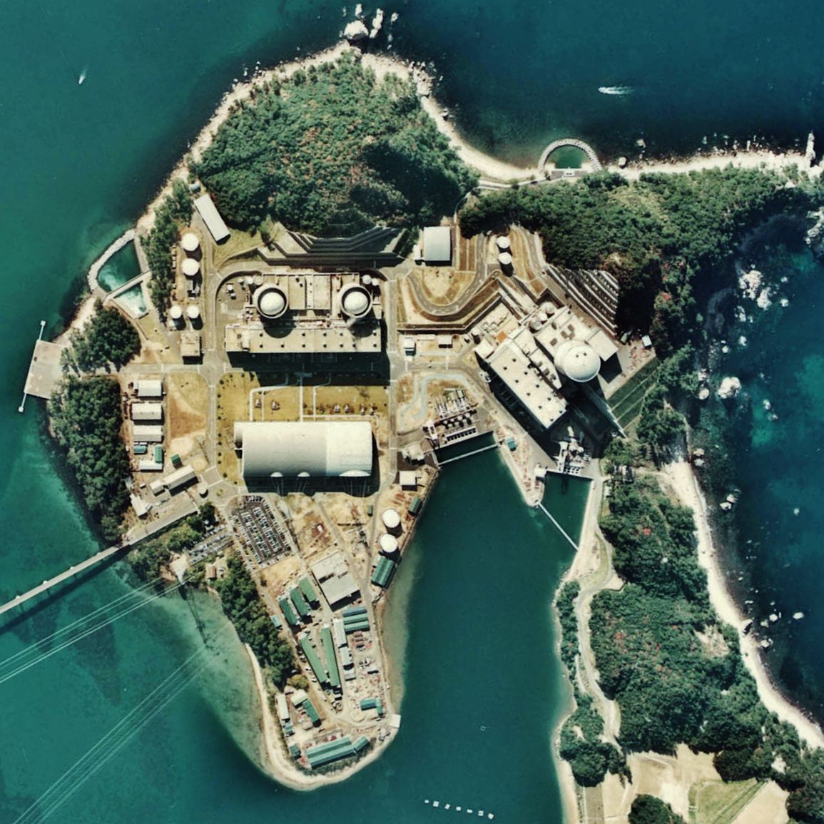
English: Mihama Nuclear Power Plant.
日本語: 美浜発電所。 |
| Date | |
| Source | Japan Ministry of Land, Infrastructure and Transport. [1] |
| Auteur | retouch: Qurren (talk). |
| Lieu de la prise de vue | | Voir cet endroit et d’autres images sur : OpenStreetMap |
|---|
Conditions d’utilisation

|
Le détenteur des droits d’auteur de ce fichier, Ministère du Territoire, des Infrastructures, des Transports et du Tourisme, autorise n’importe qui à l’utiliser pour n’importe quelle utilisation, pourvu que le détenteur des droits d’auteur soit correctement attribué. La redistribution, les œuvres dérivées, l’utilisation commerciale et toutes les autres utilisations sont autorisées. |
Attribution:
Copyright © National Land Image Information (Color Aerial Photographs), Ministry of Land, Infrastructure, Transport and Tourism
|
 |
This image is copyrighted by the Ministry of Land, Infrastructure, Transport and Tourism of Japan. For terms of use, see the stipulation to use of National Land Information (in Japanese) and message from MLIT (in Japanese and English). When you display this image on an article, include the following phrase in the description: "Made based on National Land Image Information (Color Aerial Photographs), Ministry of Land, Infrastructure, Transport and Tourism".
|
| Annotations | Cette image est annotée : Voir les annotations sur Wikimedia Commons |
Historique du fichier
Cliquer sur une date et heure pour voir le fichier tel qu'il était à ce moment-là.
| Date et heure | Vignette | Dimensions | Utilisateur | Commentaire | |
|---|---|---|---|---|---|
| actuel | 15 janvier 2011 à 10:26 | | 1 155 × 1 155 (239 kio) | Qurren | == {{int:filedesc}} == {{Information |Description={{en|1=en:Mihama Nuclear Power Plant.}} {{ja|1=ja:美浜発電所。}} |Source=Japan Ministry of Land, Infrastructure and Transport. [http://w3land.mlit.go.jp/cgi-bin/WebGIS2/WC_AirPhoto.cgi?IT |
Utilisation du fichier
La page suivante utilise ce fichier :
Usage global du fichier
Les autres wikis suivants utilisent ce fichier :
- Utilisation sur ca.wikipedia.org
- Utilisation sur de.wikipedia.org
- Utilisation sur en.wikipedia.org
- Utilisation sur ja.wikipedia.org
- Utilisation sur pl.wikipedia.org
- Utilisation sur uk.wikipedia.org
- Utilisation sur www.wikidata.org