
Fichier:MarsCones-ESP 030192 2020.jpg

Fichier d’origine (2 880 × 1 800 pixels, taille du fichier : 5,22 Mio, type MIME : image/jpeg)
Ce fichier et sa description proviennent de Wikimedia Commons.
Description
| Description |
English: NASA/JPL/University of Arizona
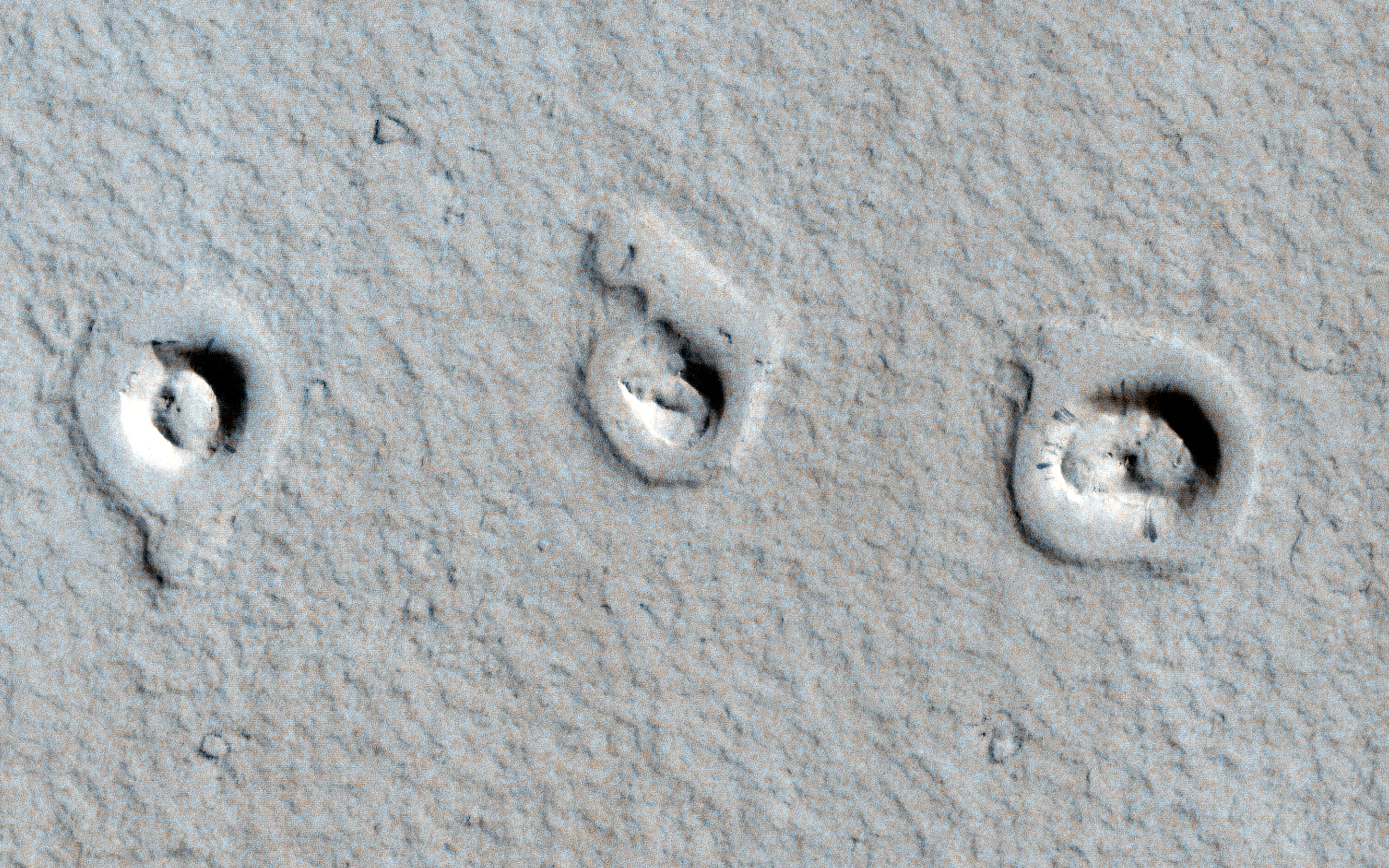
Cones and Inflated Lava Flows ESP_030192_2020 Science Theme: Volcanic Processes http://hirise.lpl.arizona.edu/ESP_030192_2020 https://www.wired.com/wiredscience/2013/01/space-photo-of-the-day-2/?pid=6342 A CTX image shows topographic cones in local depressions here. What are these and how did they form? This image reveals "rootless cones," which form on lava flows that interact with subsurface water. They are in depressions because subsequent lava flowed around the base of the cones, then "inflated." Lava inflation is a process where liquid is injected beneath the solid (thickening) crust and raises the whole surface, often raising it higher than the topography that controlled the initial lava emplacement. This scene is in Amazonis Planitia, a vast region covered by flood lava. The surface is coated by a thin layer of reddish dust, which avalanches down steep slopes to make dark streaks. Written by: Alfred McEwen (audio by Tre Gibbs) (20 February 2013)Acquisition date: 04 January 2013 Local Mars time: 3:14 PM Latitude (centered): 21.965 degrees Longitude (East): 197.807 degrees Range to target site: 288.0 km (180.0 miles) Original image scale range: 57.6 cm/pixel (with 2 x 2 binning) so objects ~173 cm across are resolved Map projected scale: 50 cm/pixel and North is up Map projection: EQUIRECTANGULAR Emission angle: 2.9 degrees Phase angle: 61.9 degrees Solar incidence angle: 64 degrees, with the Sun about 26 degrees above the horizon Solar longitude: 238.2 degrees, Northern Autumn For non-map projected products: North azimuth: 97 degrees Sub-solar azimuth: 327.0 degrees For map-projected products North azimuth: 270 degrees Sub solar azimuth: 141.4 degrees |
| Date | |
| Source | http://hirise.lpl.arizona.edu/images/wallpaper/2880/ESP_030192_2020.jpg |
| Auteur | NASA/JPL/University of Arizona |
Conditions d’utilisation
| Ce fichier provient de la NASA. Sauf exception, les documents créés par la NASA ne sont pas soumis à copyright. Pour plus d'informations, voir la politique de copyright de la NASA. | ||
 |
Attention :
|
Historique du fichier
Cliquer sur une date et heure pour voir le fichier tel qu'il était à ce moment-là.
| Date et heure | Vignette | Dimensions | Utilisateur | Commentaire | |
|---|---|---|---|---|---|
| actuel | 23 février 2013 à 16:46 | | 2 880 × 1 800 (5,22 Mio) | Drbogdan | User created page with UploadWizard |
Utilisation du fichier
La page suivante utilise ce fichier :
Usage global du fichier
Les autres wikis suivants utilisent ce fichier :
- Utilisation sur en.wikipedia.org
- Utilisation sur ja.wikipedia.org
- Utilisation sur nl.wikipedia.org
- Utilisation sur ru.wikipedia.org
- Utilisation sur sv.wikipedia.org
- Utilisation sur uk.wikipedia.org
- Utilisation sur zh.wikipedia.org