
Fichier:Alberta-rockies map.png
Taille de cet aperçu : 341 × 599 pixels. Autres résolutions : 136 × 240 pixels | 352 × 618 pixels.
Fichier d’origine (352 × 618 pixels, taille du fichier : 37 kio, type MIME : image/png)
Ce fichier et sa description proviennent de Wikimedia Commons.
Description
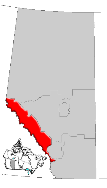
| Description | Map of Rockies Region, Alberta, Canada |
| Date | |
| Source | GIS data |
| Auteur | Qyd (d · contributions) |
| Autorisation (Réutilisation de ce fichier) |
All |
Conditions d’utilisation
| Moi, propriétaire des droits d’auteur sur cette œuvre, la place dans le domaine public. Ceci s'applique dans le monde entier. Dans certains pays, ceci peut ne pas être possible ; dans ce cas : J’accorde à toute personne le droit d’utiliser cette œuvre dans n’importe quel but, sans aucune condition, sauf celles requises par la loi. |
Historique du fichier
Cliquer sur une date et heure pour voir le fichier tel qu'il était à ce moment-là.
| Date et heure | Vignette | Dimensions | Utilisateur | Commentaire | |
|---|---|---|---|---|---|
| actuel | 4 janvier 2007 à 18:29 | | 352 × 618 (37 kio) | Qyd | {{Information |Description=Map of Rockies Region, Alberta, Canada |Source=GIS data |Date=Jan 2006 |Author={{User|Qyd}} |Permission=All |other_versions= }} Category:Maps of Alberta |
Utilisation du fichier
Aucune page n’utilise ce fichier.
Usage global du fichier
Les autres wikis suivants utilisent ce fichier :
- Utilisation sur de.wikipedia.org
- Utilisation sur en.wikipedia.org
- Mount Galatea
- Castle Junction
- Mount Mitchell (Alberta)
- Mount Cromwell
- Mount GEC
- Gong Peak
- Thorington Tower
- Mount Adam Joachim
- Mount Morden Long
- Mount McGuire (Alberta)
- Mount Confederation
- Little Alberta
- Mount King Edward
- Hidden Lake (Alberta)
- Kananaskis Range
- Mount Andromeda (Alberta)
- Beatrice Peak
- Isabelle Peak
- Haiduk Peak
- Mount Inglismaldie
- Mount Charles Stewart
- Fossil Mountain (Alberta)
- Mount Chester
- Mount Cornwell (Canada)
- Mount Cory (Alberta)
- Bare Range
- Blue Range
- Peyto Lake
- Heart Mountain (Alberta)
- Athabasca Falls
- Bow Falls
- Mount Baldy (Alberta)
- Elbow Falls
- Bow Valley
- Canyon Creek Ice Cave
- Sentinel Peak (Alberta)
- Lake Agnes (Alberta)
- Copper Mountain (Alberta)
- Massive Range
- Division No. 15, Alberta
- Medicine Lake (Alberta)
- Tonquin Valley
- Athabasca Glacier
- Trapper Peak (Canada)
- Peyto Peak
- Abbot Pass
- Saint Nicholas Peak (Canada)
- Blackrock Mountain (Alberta)
- Vermilion Lakes
Voir davantage sur l’utilisation globale de ce fichier.